MyTopo
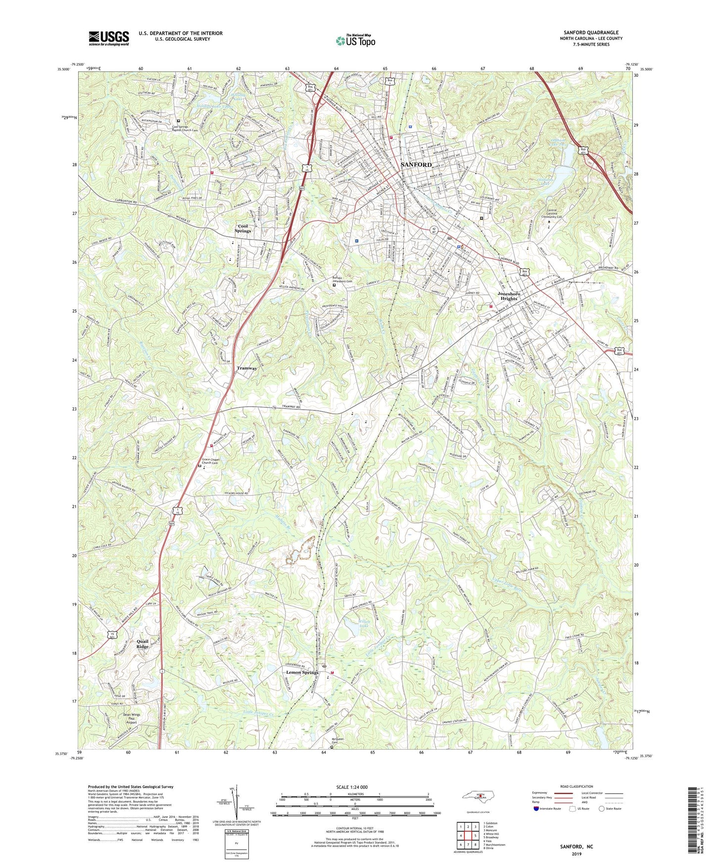
Sanford North Carolina US Topo Map
Couldn't load pickup availability
2022 topographic map quadrangle Sanford in the state of North Carolina. Scale: 1:24000. Based on the newly updated USGS 7.5' US Topo map series, this map is in the following counties: Lee. The map contains contour data, water features, and other items you are used to seeing on USGS maps, but also has updated roads and other features. This is the next generation of topographic maps. Printed on high-quality waterproof paper with UV fade-resistant inks.
Quads adjacent to this one:
West: White Hill
Northwest: Goldston
North: Colon
Northeast: Moncure
East: Broadway
Southeast: Olivia
South: Murchisontown
Southwest: Vass
This map covers the same area as the classic USGS quad with code o35079d2.
Contains the following named places: Berkley Place, Bragg Street School, Brentwood, Brookhaven, Brookwood, Buffalo - Jonesboro Cemetery, Buffalo Church, Carbonton Heights, Central Carolina Advanced Life Support Emergency Medical Services, Central Carolina Hospital, Central Carolina Technical Institute, Central High School, City of Sanford, Clearwater Forest, Colonial Acres, Cool Springs, Cool Springs Baptist Church Cemetery, Country Lane Estates, Courtland Acres, Dean Field, Faith Tabernacle, Gasters Creek, Grace Chapel, Grace Chapel Church Cemetery, Greenwood School, Hanover Circle, Holiday Lake, Holiday Lake Upper, Holiday Lake Upper Dam, Jonesboro Heights, Kendale Shopping Center, Kendall Acres, Knight School, Lee County, Lee County Sheriff's Office, Lemon Springs, Lemon Springs Church, Lemon Springs Post Office, Lemon Springs Quarry, Lemon Springs Volunteer Fire Department, Little Juniper Creek, Longview Acres, Marsh Memorial Church, McCracken Heights, McIver School, McQueen Cemetery, Meadow Park, Morris Pond, Morris Pond Dam, Mount Zion Church, Mulatto Branch, Oldham Lake Lower Dam, Oldham Lake One, Oldham Lake Two, Oldham Lake Upper Dam, Oldhams Lake, Owls Nest, Parkwood Estates, Persimmon Creek, Planters Ridge, Quail Ridge, Robinson Chapel, Royal Oaks, Saint Andrews, Saint Clair School, Saint Lukes Church, Sanford, Sanford Correctional Center, Sanford Fire Department Central Station, Sanford Fire Department Station 2, Sanford Fire Department Station 3, Sanford Mall, Sanford Police Department, Sanford Post Office, Sanford Shopping Center, San-Lee Park, Skunk Creek, Sunset Terrace, Township 2-Jonesboro, Trails End, Tramway, Tramway Rural Fire Department, W B Wicker Elementary School, WDCC-FM (Sanford), West Lake Valley, West Lee Junior High School, Westcroft, Western Hills, WFJA-FM (Sanford), Willett Lake, Willette Lake Dam, Williams School, Winstead Pond, Winstead Pond Dam, Woodbridge, WSBL-AM (Sanford), WWGP-AM (Sanford), ZIP Code: 27332