MyTopo
Bynum North Carolina US Topo Map
Couldn't load pickup availability
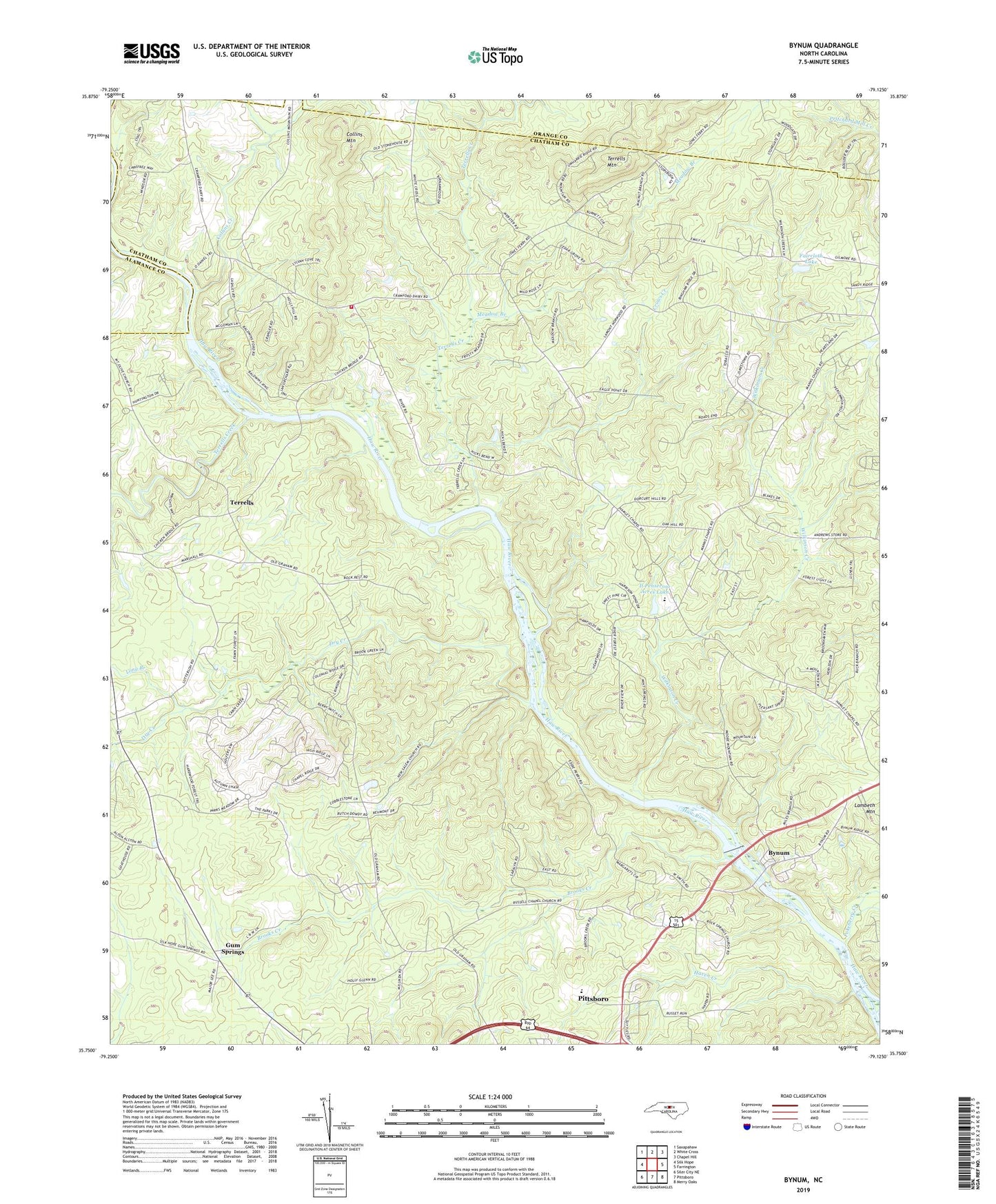
2019 topographic map quadrangle Bynum in the state of North Carolina. Scale: 1:24000. Based on the newly updated USGS 7.5' US Topo map series, this map is in the following counties: Chatham, Orange, Alamance. The map contains contour data, water features, and other items you are used to seeing on USGS maps, but also has updated roads and other features. This is the next generation of topographic maps. Printed on high-quality waterproof paper with UV fade-resistant inks.
Quads adjacent to this one:
West: Silk Hope
Northwest: Saxapahaw
North: White Cross
Northeast: Chapel Hill
East: Farrington
Southeast: Merry Oaks
South: Pittsboro
Southwest: Siler City NE
Contains the following named places: Baldwin Mill Pond, Baldwin Millpond Dam, Big Branch, Brooks Creek, Browns Chapel, Bynum, Cedar Grove Church, Collins Creek, Collins Mountain, Crows Creek, Dry Creek, Faircloth Lake, Faircloth Lake Dam, Gum Springs, Hamlets Chapel, Haven Creek, Il Penseroso Acres Lake, Il Penseroso Acres Lake Dam, Long Branch, Manns Chapel, Meadow Branch, Mount Pleasant Church, New Salem Church, North Chatham Volunteer Fire Department Station 4, Odell Pond, Odell Pond Dam, Persimmon Nursery Branch, Pokeberry Creek, Rock Springs Church, Russells Chapel, Terrells, Terrells Chapel, Terrells Creek, Terrells Mountain, Township of Baldwin, WDCG-FM (Durham), Wilkinson Creek, Williams Pond, Williams Pond Dam, WUNC-FM (Chapel Hill), WUNC-TV (Chapel Hill), ZIP Code: 27312