MyTopo
Merry Oaks North Carolina US Topo Map
Couldn't load pickup availability
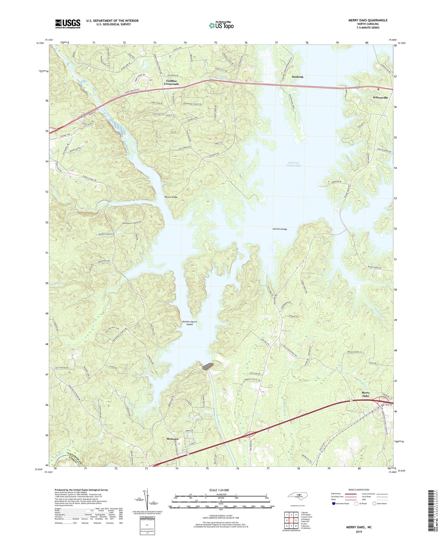
2022 topographic map quadrangle Merry Oaks in the state of North Carolina. Scale: 1:24000. Based on the newly updated USGS 7.5' US Topo map series, this map is in the following counties: Chatham, Lee. The map contains contour data, water features, and other items you are used to seeing on USGS maps, but also has updated roads and other features. This is the next generation of topographic maps. Printed on high-quality waterproof paper with UV fade-resistant inks.
Quads adjacent to this one:
West: Pittsboro
Northwest: Bynum
North: Farrington
Northeast: Green Level
East: New Hill
Southeast: Cokesbury
South: Moncure
Southwest: Colon
This map covers the same area as the classic USGS quad with code o35079f1.
Contains the following named places: B Everett Jordan Dam, B Everett Jordan Lake, Beaver Creek, Ebenezer Church, Griffins Crossroads, Gum Spring Church, Gunter-Harris Island, Hanks Chapel, Johnsons Bridge, Kirks Creek, Little Beaver Creek, Merry Oaks, Moncure School, Moores Bridge, Mount View Church, New Elam Church, New Hope Dam, New Hope River, Parkers Creek, Pleasant Hill Church, Providence Church, Roberson Creek, Seaforth, Seaforth Lake, Stinking Creek, Township of Haw River, Township of New Hope, Weaver Creek, White Oak Creek, Wilsonville, Windfall Branch, ZIP Code: 27559