MyTopo
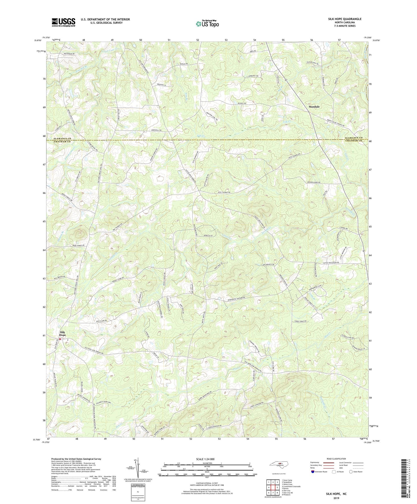
Silk Hope North Carolina US Topo Map
Couldn't load pickup availability
2022 topographic map quadrangle Silk Hope in the state of North Carolina. Scale: 1:24000. Based on the newly updated USGS 7.5' US Topo map series, this map is in the following counties: Chatham, Alamance. The map contains contour data, water features, and other items you are used to seeing on USGS maps, but also has updated roads and other features. This is the next generation of topographic maps. Printed on high-quality waterproof paper with UV fade-resistant inks.
Quads adjacent to this one:
West: Crutchfield Crossroads
Northwest: Snow Camp
North: Saxapahaw
Northeast: White Cross
East: Bynum
Southeast: Pittsboro
South: Siler City NE
Southwest: Siler City
This map covers the same area as the classic USGS quad with code o35079g3.
Contains the following named places: Camp Maranatha Lake, Camp Maranatha Lake Dam, Cattail Creek, Center Church, Emmaus Church, Johnson Branch, Lick Creek, Mandale, Mellow Marsh Farms, Mount Olive Church, Mount Vernon Church, Pine Hill Branch, Sapling Ridge Church, Silk Hope, Silk Hope Elementary School, Silk Hope Volunteer Fire Department Station 7, South Fork Church, Township of Hadley, Triple M Farms, West Grove Church