MyTopo
Catawba North Carolina US Topo Map
Couldn't load pickup availability
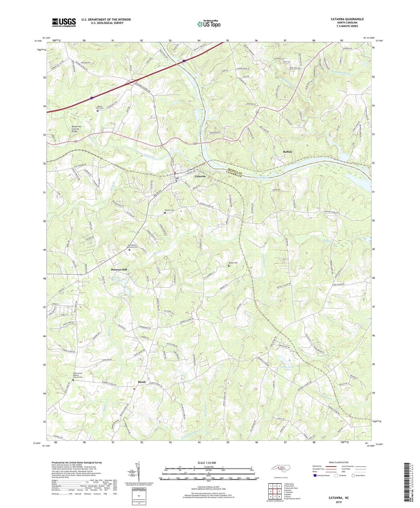
2019 topographic map quadrangle Catawba in the state of North Carolina. Scale: 1:24000. Based on the newly updated USGS 7.5' US Topo map series, this map is in the following counties: Catawba, Iredell. The map contains contour data, water features, and other items you are used to seeing on USGS maps, but also has updated roads and other features. This is the next generation of topographic maps. Printed on high-quality waterproof paper with UV fade-resistant inks.
Quads adjacent to this one:
West: Newton
Northwest: Millersville
North: Stony Point
Northeast: Statesville West
East: Troutman
Southeast: Lake Norman North
South: Denver
Southwest: Maiden
Contains the following named places: Balls Creek Campground, Bandy, Bandy's Crossroads Volunteer Fire Department Station 9 Base 1, Battle Run, Broad Meadow Creek, Brooks Cemetery, Browns Chapel, Buffalo, Buffalo Shoals Creek, Bunker Hill Covered Bridge, Catawba, Catawba Police Department, Catawba Post Office, Catawba Rescue Squad, Catawba Rosenwald Education Center School, Catawba Volunteer Fire Department Station 8, Center Church, Comm Scope Dam, Comm Scope Lake, Ebenezer Church, Elmore Dam, Elmore Lake, Gold Mine Creek, Hagan Fork, Hopewell Church, Hudson Chapel, Lyle Creek, Mathis Chapel, McLin Creek, Mount Olive Cemetery, Mount Sinai Church, Mount View Church, Murrays Hill, Murrays Mill Lake, Murrays Mill Pond Dam, North Fork Mountain Creek, Piney Grove Baptist Church Cemetery, Piney Grove Church, Pleasant Grove Church, Providence Church, Providence Memorial Cemetery, Shiloh Church, Smyres Cemetery, Smyres Chapel, Smyrna Church, Town of Catawba, Township of Catawba, Welcome Church, ZIP Code: 28609