MyTopo
Stony Point North Carolina US Topo Map
Couldn't load pickup availability
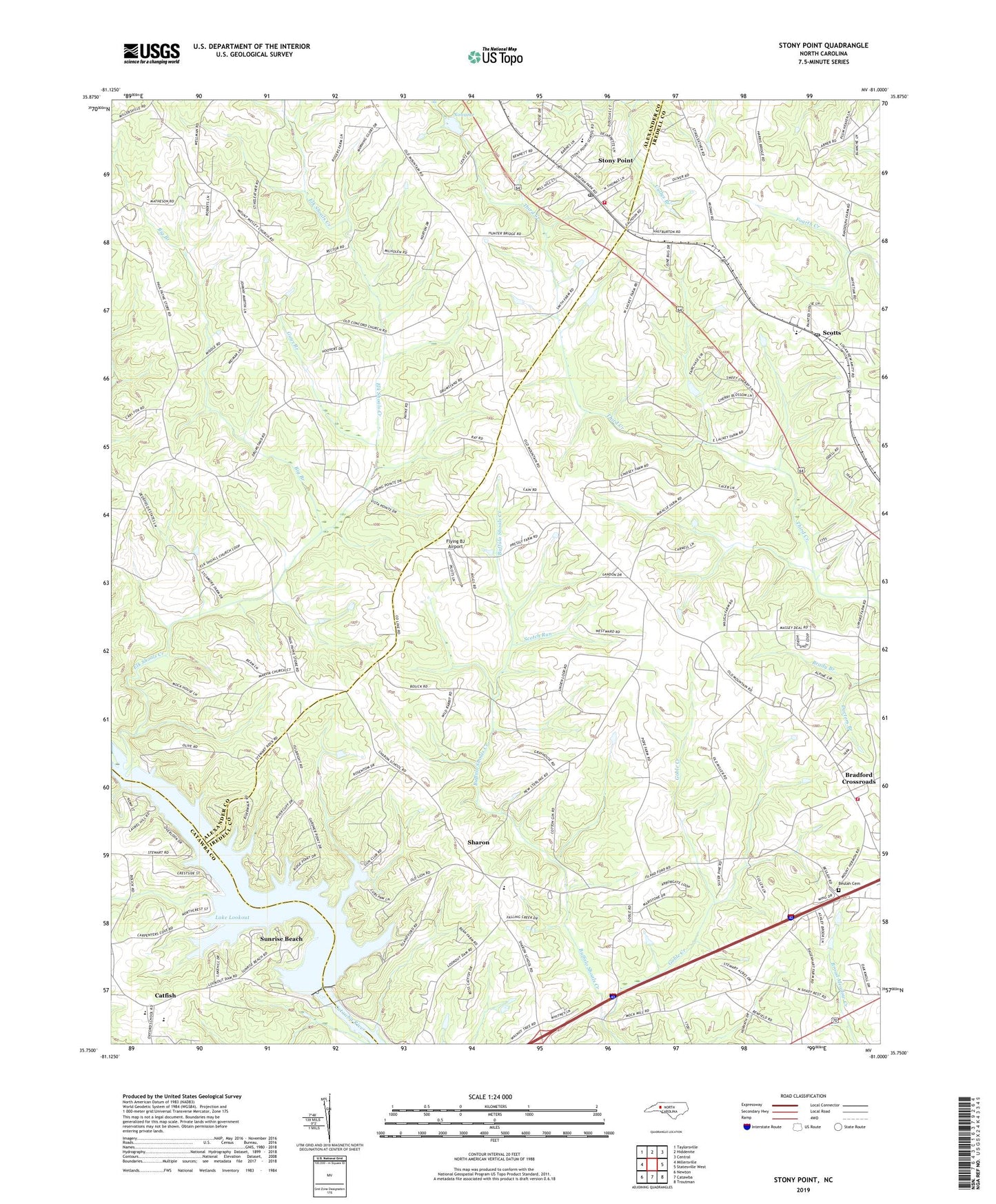
2022 topographic map quadrangle Stony Point in the state of North Carolina. Scale: 1:24000. Based on the newly updated USGS 7.5' US Topo map series, this map is in the following counties: Iredell, Alexander, Catawba. The map contains contour data, water features, and other items you are used to seeing on USGS maps, but also has updated roads and other features. This is the next generation of topographic maps. Printed on high-quality waterproof paper with UV fade-resistant inks.
Quads adjacent to this one:
West: Millersville
Northwest: Taylorsville
North: Hiddenite
Northeast: Central
East: Statesville West
Southeast: Troutman
South: Catawba
Southwest: Newton
This map covers the same area as the classic USGS quad with code o35081g1.
Contains the following named places: Bethel Church, Beulah Church Cemetery, Big Branch, Bradford Crossroads, Brevard, Bunker Hill High School, C A Lackey Dam, Catfish, Concord Church, Doctors Branch, Elk Shoals Church, Elk Shoals Creek, Flying BJ Airport, Goble Creek, Guys Branch, Hill Lake, Hill Lake Dam, Island Ford, Lake Lookout, Lookout Shoals Dam, Lookout Shoals Lake, Marvin Church, Moores, Mount Hermon Church, Mount Nebo Church, Mount Wesley Church, New Amity Church, New Salem Church, New Sterling Church, Noname, Philadelphia Church, Pleasant Home Church, Providence Church, Scotts, Scotts Post Office, Scotts School, Sharon, Sharon Elementary School, Stony Point, Stony Point Census Designated Place, Stony Point Post Office, Stony Point Volunteer Fire Department, Sunrise Beach, Third Creek Church, Third Creek Watershed Dam Number Nine, Third Creek Watershed Dam Ten, Township of Millers, Township of Shiloh, West Iredell Volunteer Fire Department, ZIP Code: 28678