MyTopo
Denver North Carolina US Topo Map
Couldn't load pickup availability
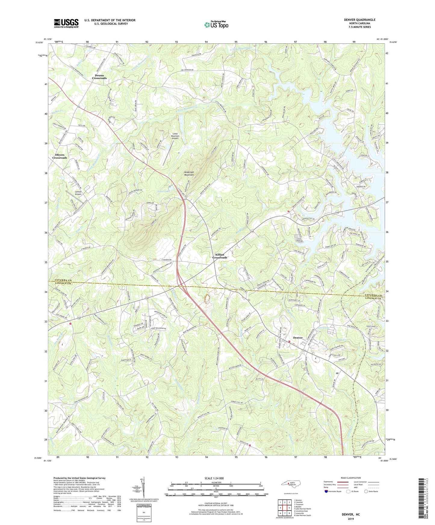
2019 topographic map quadrangle Denver in the state of North Carolina. Scale: 1:24000. Based on the newly updated USGS 7.5' US Topo map series, this map is in the following counties: Catawba, Lincoln. The map contains contour data, water features, and other items you are used to seeing on USGS maps, but also has updated roads and other features. This is the next generation of topographic maps. Printed on high-quality waterproof paper with UV fade-resistant inks.
Quads adjacent to this one:
West: Maiden
Northwest: Newton
North: Catawba
Northeast: Troutman
East: Lake Norman North
Southeast: Lake Norman South
South: Lowesville
Southwest: Lincolnton East
Contains the following named places: Anderson Mountain, Bethel Church, Bevard Church, Camp Dogwood, Center View Church, Denver, Denver Census Designated Place, Denver Post Office, Denver Volunteer Fire Department, Denver Volunteer Fire Department Kidville Station, Drums Crossroads, Friendly Church, Jones Lake, Jones Lake Dam, Killian Crossroads, Laneys Airport, Lebanon Church, Lincoln County Emergency Medical Services, Little Mountain Aircraft Dam, Little Mountain Aircraft Lake, Little Mountain Airport, Mount Anderson Church, Mount Pleasant Church, Mountain Beulah Church, Mountain View Church, Mundy Creek, Olivers Crossroads, Ore Bank Pumpkin Center Volunteer Fire Department, Pisgah Church, Pooles Chapel, Quinlen Lake, Quinlen Lake Dam, Reed Creek, Rock Springs, Rock Springs Campground, Rock Springs Elementary School, Sherrills Ford Terrell Fire and Rescue Base 2, South Fork Mountain Creek, Thompson Memorial Church, Township of Mountain Creek, Victory Church, Wilkinson Creek