MyTopo
Lake Norman South North Carolina US Topo Map
Couldn't load pickup availability
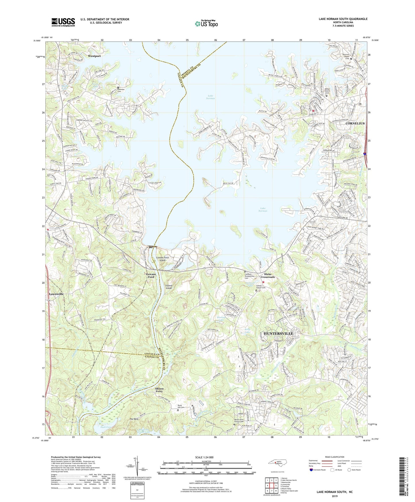
2022 topographic map quadrangle Lake Norman South in the state of North Carolina. Scale: 1:24000. Based on the newly updated USGS 7.5' US Topo map series, this map is in the following counties: Mecklenburg, Lincoln, Gaston, Iredell. The map contains contour data, water features, and other items you are used to seeing on USGS maps, but also has updated roads and other features. This is the next generation of topographic maps. Printed on high-quality waterproof paper with UV fade-resistant inks.
Quads adjacent to this one:
West: Lowesville
Northwest: Denver
North: Lake Norman North
Northeast: Mooresville
East: Cornelius
Southeast: Derita
South: Mountain Island Lake
Southwest: Mount Holly
This map covers the same area as the classic USGS quad with code o35080d8.
Contains the following named places: Allison Ferry, Auten Nature Preserve, Beatty Ford Access Area, Beatty Ford Islands, Beattys Ford, Bethel Church, Bethel Church Cemetery, Black Trailer Park, Burton Creek, Caldwell Presbyterian Cemetery, Caldwell Station Creek, Catawba Church, Cookson Dairy Farm, Cornelius - Lemley Volunteer Fire and Rescue Station 2, Cornelius Post Office, Cove Haven, Cowans Ford, Cowans Ford Dam, Cowans Ford Island, Cowans Ford Overlook, Cowans Ford Visitors Center, Cowans Ford Wildlife Refuge, Duck Cove, East Lincoln High School, Ebenezer Cemetery, Ebenezer Church, Francis Bradley Middle School, General Davidson Memorial Historic Site, Gilead Church, Gilead Church Cemetery, Graham Creek, Graham Island, Hager Creek, Hasting Lake, Hicks Crossroads, Holiday Harbor, Hopewell High School, Hunter Chapel, Huntersville Fire Department Station 2, Johnson Creek, Kelly Lake, Kings Point Marina, Knox Creek, Lincoln Emergency Medical Services, Long Creek School, Lowesville Census Designated Place, Lucky Creek, Marthas Chapel, McGuire Nuclear Station, Mount Olive Baptist Church, Mount Olive Church Cemetery, Nixon Lake, Outrigger Harbor, Ramsey Creek, Ramsey Creek County Park, Ranger Island Marina, Rural Hill Cemetery, Salem Church, Sifford Island, Smith Lake, Southlake Christian Academy, Southlake Presbyterian Church, Stephens Road Nature Preserve, Stillwell Lake, The Neck, Torrence Chapel, Torrence Chapel Cemetery, Torrence Creek, Town of Cornelius, Township 10-Lemley, Triangle School, Union Grove Church, Unity Church, Vineyard Point Marina, Westport Church, Westport Golf Course, Wher-Rena Marina, ZIP Code: 28031