MyTopo
Dublin North Carolina US Topo Map
Couldn't load pickup availability
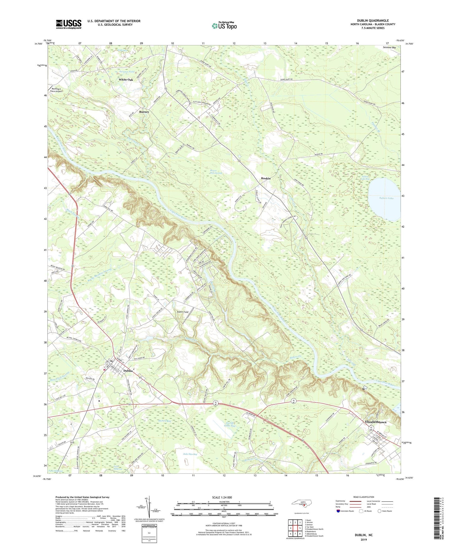
2019 topographic map quadrangle Dublin in the state of North Carolina. Scale: 1:24000. Based on the newly updated USGS 7.5' US Topo map series, this map is in the following counties: Bladen. The map contains contour data, water features, and other items you are used to seeing on USGS maps, but also has updated roads and other features. This is the next generation of topographic maps. Printed on high-quality waterproof paper with UV fade-resistant inks.
Quads adjacent to this one:
West: Tar Heel
Northwest: Duart
North: Jerome
Northeast: Ammon
East: Elizabethtown North
Southeast: Elizabethtown South
South: Abbottsburg
Southwest: Bladenboro
Contains the following named places: Bakers Creek, Bakers Creek Church, Beaver Dam Swamp, Bethel Church, Bladen Community College, Bladen Correctional Center, Bomill Branch, Browns Creek Church, Burney, Deans Chapel, Dublin, Dublin Field, Dublin Post Office, Dublin Volunteer Fire Department, Elizabethtown Baptist Church, Ellis Creek, Ellis Creek Church, Harrison Creek, Harrison Creek Church, Jones Lake State Park, McCord Church, McNeil Bay, Purdie Church, Richardson Chapel, Ruskin, Saint Christophers Church, Salters Lake, Salters Lake Bay, Sheriff White Bay, Shiloh Church, Swamp Field, Town of Dublin, Township of Bethel, White Oak, White Oak Census Designated Place, Yorick, ZIP Code: 28332