MyTopo
Elizabethtown North North Carolina US Topo Map
Couldn't load pickup availability
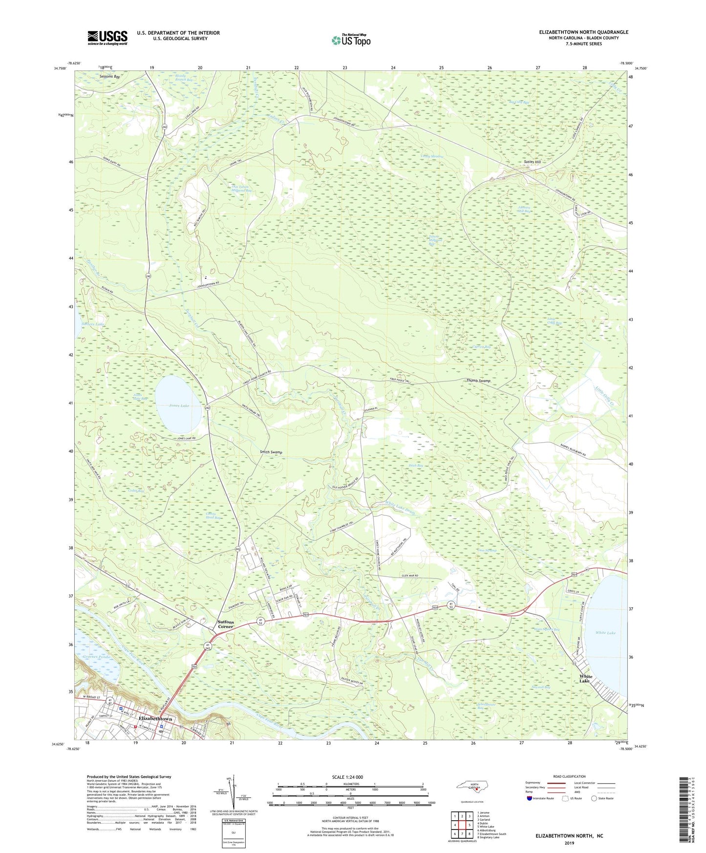
2022 topographic map quadrangle Elizabethtown North in the state of North Carolina. Scale: 1:24000. Based on the newly updated USGS 7.5' US Topo map series, this map is in the following counties: Bladen. The map contains contour data, water features, and other items you are used to seeing on USGS maps, but also has updated roads and other features. This is the next generation of topographic maps. Printed on high-quality waterproof paper with UV fade-resistant inks.
Quads adjacent to this one:
West: Dublin
Northwest: Jerome
North: Ammon
Northeast: Garland
East: White Lake
Southeast: Singletary Lake
South: Elizabethtown South
Southwest: Abbottsburg
This map covers the same area as the classic USGS quad with code o34078f5.
Contains the following named places: Bladen County Sheriff's Office, Bladen County Water Rescue - White Lake, Bladen Lakes Airport, Bladen Lakes School, Bladen Lakes State Forest, Bloody Branch Bay, Briar Branch Church, Browns Creek, Browns Landing, Bureau of Investigation, Caney Meadow, Cedar Bay, Cotton Head Bay, Cypress Bay, Ditch Bay, Elizabethtown, Elizabethtown City Hall, Elizabethtown Dock, Elizabethtown Fire Department, Elizabethtown Junior High School, Elizabethtown Police Department, Elizabethtown Post Office, Greenes Pond, Greens Pond Dam, Gum Swamp, Indian Creek, Johnson Mill Bay, Johnsontown, Jones Lake, Jones Lake Bay, Jones Lake Lookout Tower, Little Colly Bay, Martins Chapel, Mount Carmel Church, Mount Zion Church, Olin Tatum Millpond Bay, Panther Branch, Prison Number 601, Saint John Church, Saint Rest Church, Sawmill Bay, Schoolhouse Bay, Smith Swamp, Susies Hill, Suttons Corner, Sweet Home Church, Tatum Millpond Bay, Thumb Swamp, Township of Central, Tub Mill Creek, US Lock and Dam Number 2, Wam Squam Bay, WBLA-AM (Elizabethtown), White Lake Drain, ZIP Code: 28337