MyTopo
Duart North Carolina US Topo Map
Couldn't load pickup availability
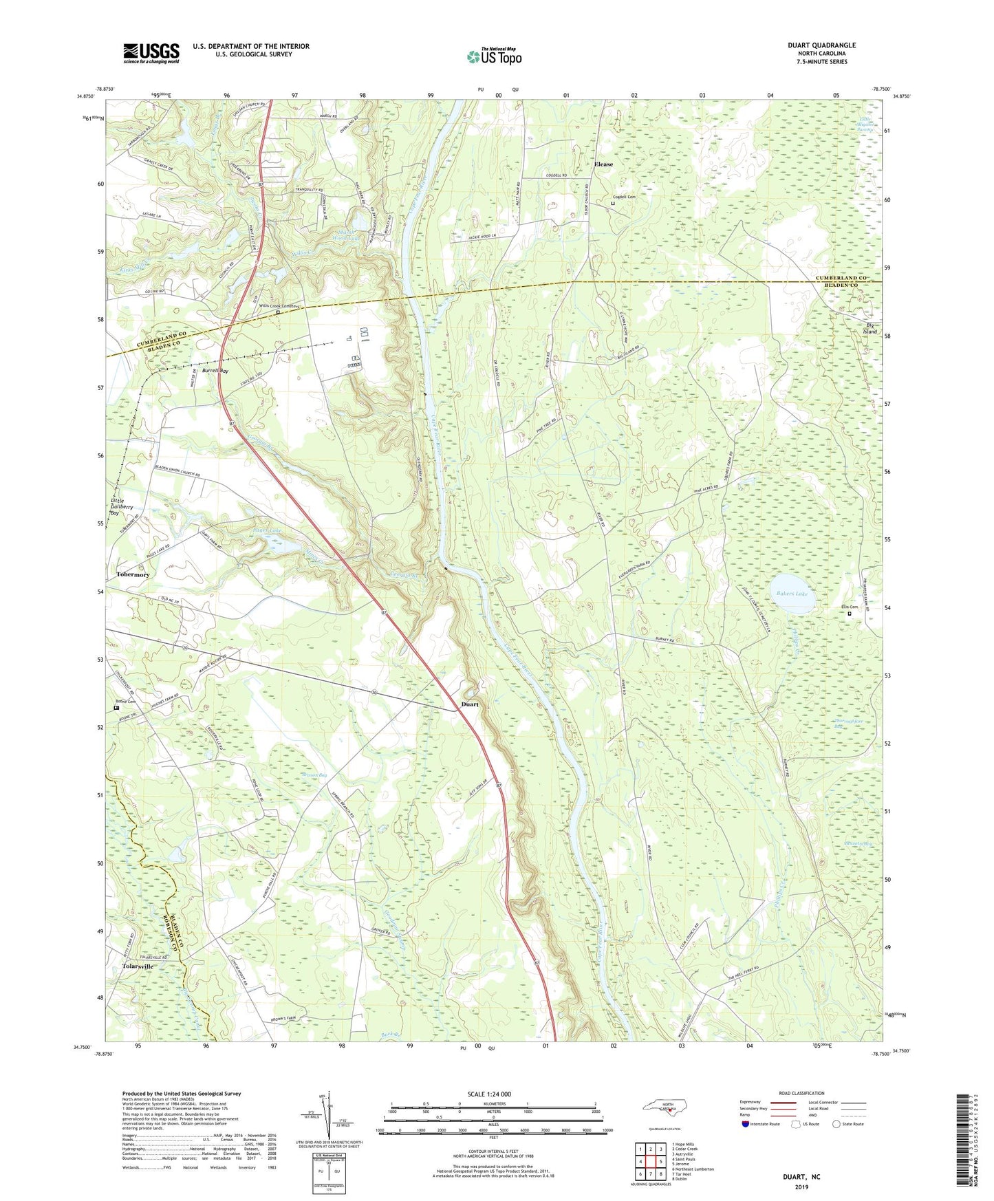
2022 topographic map quadrangle Duart in the state of North Carolina. Scale: 1:24000. Based on the newly updated USGS 7.5' US Topo map series, this map is in the following counties: Bladen, Cumberland, Robeson. The map contains contour data, water features, and other items you are used to seeing on USGS maps, but also has updated roads and other features. This is the next generation of topographic maps. Printed on high-quality waterproof paper with UV fade-resistant inks.
Quads adjacent to this one:
West: Saint Pauls
Northwest: Hope Mills
North: Cedar Creek
Northeast: Autryville
East: Jerome
Southeast: Dublin
South: Tar Heel
Southwest: Northeast Lumberton
This map covers the same area as the classic USGS quad with code o34078g7.
Contains the following named places: Bakers Lake, Big Marsh Swamp, Bladen Union Church, Boone Cemetery, Brisson Bay, Burrell Bay, Cedar Creek Fish Farm, Chapel Grove Church, Cogdell Cemetery, Duart, Elease, Ellis Cemetery, Gallberry Swamp, Georgia Branch, Kirks Mill Creek, Little Alligator Swamp, Longs Branch, Marsh Wood Lake, Marsh Wood Lake Dam, Millars Chapel, Miller Chapel, Mines Creek, Newlight, Newlight School, Pages Lake, Pages Lake Dam, Prospect Hall Landing, Saint Rest Church, Second Newlight Church, Spring Branch Church, Swans Creek, Thoroughfare Bay, Tolar Landing, Tolarsville, Township of Hollow, Verdery Pond, Verdery Pond Dam, William O Huske Lock and Dam Number 3, Willis Creek, Willis Creek Cemetery, Willis Creek Church