MyTopo
Enochville North Carolina US Topo Map
Couldn't load pickup availability
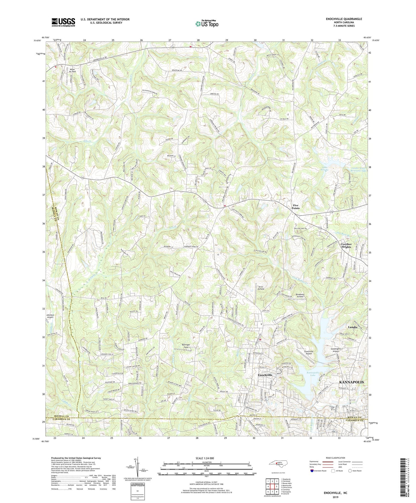
2019 topographic map quadrangle Enochville in the state of North Carolina. Scale: 1:24000. Based on the newly updated USGS 7.5' US Topo map series, this map is in the following counties: Rowan, Cabarrus, Iredell. The map contains contour data, water features, and other items you are used to seeing on USGS maps, but also has updated roads and other features. This is the next generation of topographic maps. Printed on high-quality waterproof paper with UV fade-resistant inks.
Quads adjacent to this one:
West: Mooresville
Northwest: Shepherds
North: Cleveland
Northeast: Rowan Mills
East: China Grove
Southeast: Concord
South: Kannapolis
Southwest: Cornelius
Contains the following named places: Atwell Township Volunteer Fire Department, Baker Creek Park, Barringer Field, Broadway Airfield, Concordia Church, Corriher Heights, Doctor SMcCorkle School, East Fork, Enochville, Enochville Airport, Enochville Census Designated Place, Enochville Elementary School, Enochville Fire and Rescue Department Station 49, Ervin Airfield, Five Points, Full Gospel Church, Goodnight's Airport, Gospel Light Church, Harts, Kannapolis Golf Course, Kannapolis Lake, Lake Kannapolis Dam, Lake Wright, Landis Water Reservoir Dam, Landis Water Reservoir Lake, McKnight School, Mill Hill, Miller Air Park, Miranda, Oak Grove Church, Pleasant Grove Church, Prospect Church, Saint Enochs Church, Saint Pauls Church, Sills Church, Township of Atwell, University Church, West A Street Church, West Corinth Church, West Rowan Fire Department Station 65 Centenary, West Rowan Fire Department Station 68 Caldwell, Westside Church, ZIP Code: 28081