MyTopo
Cleveland North Carolina US Topo Map
Couldn't load pickup availability
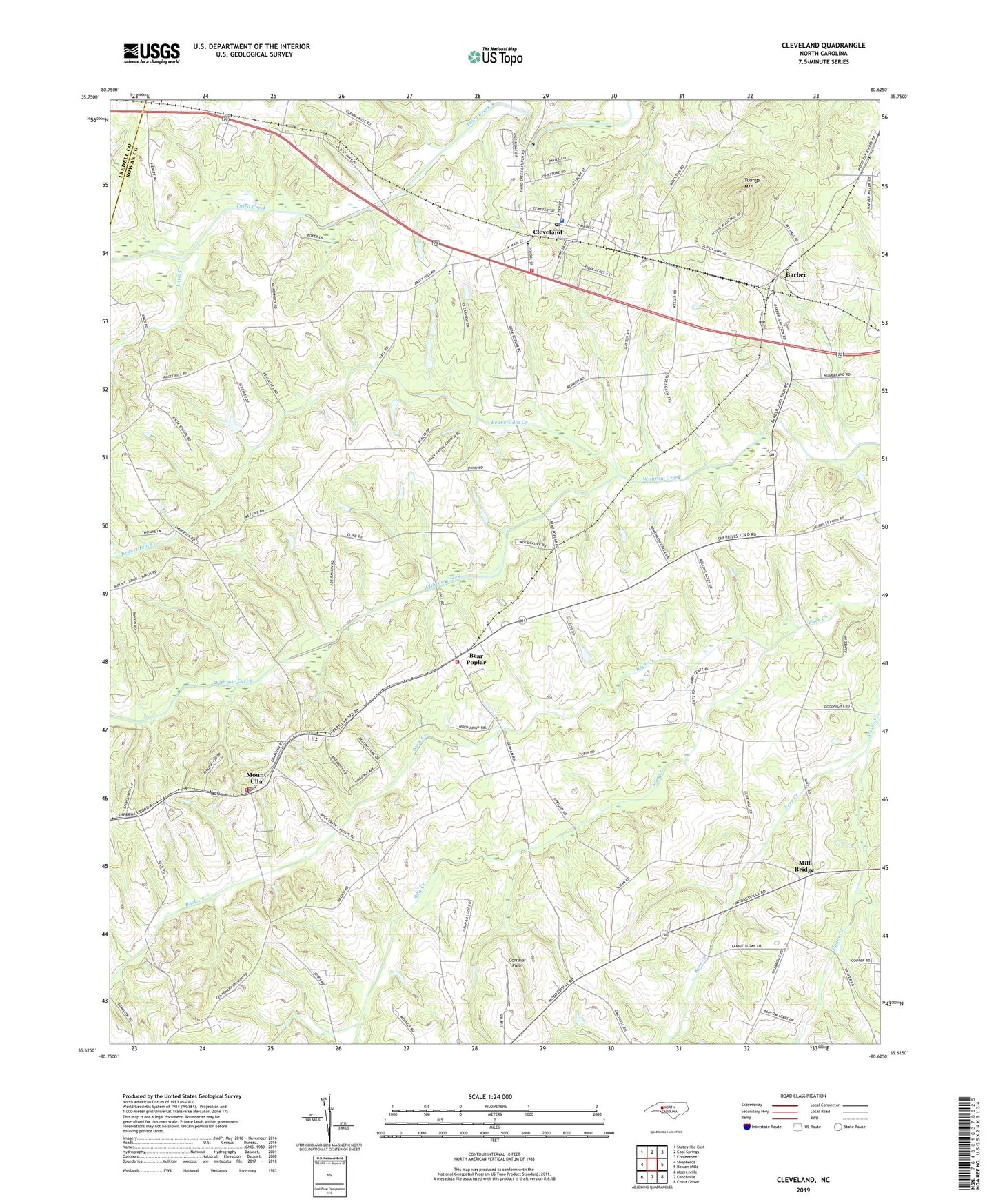
2022 topographic map quadrangle Cleveland in the state of North Carolina. Scale: 1:24000. Based on the newly updated USGS 7.5' US Topo map series, this map is in the following counties: Rowan, Iredell. The map contains contour data, water features, and other items you are used to seeing on USGS maps, but also has updated roads and other features. This is the next generation of topographic maps. Printed on high-quality waterproof paper with UV fade-resistant inks.
Quads adjacent to this one:
West: Shepherds
Northwest: Statesville East
North: Cool Springs
Northeast: Cooleemee
East: Rowan Mills
Southeast: China Grove
South: Enochville
Southwest: Mooresville
This map covers the same area as the classic USGS quad with code o35080f6.
Contains the following named places: Back Creek, Back Creek Church, Barber, Bear Poplar, Beaverdam Creek, Blackmer, Chowansville, Cleveland, Cleveland Community Volunteer Fire Department Station 45, Cleveland Elementary School, Cleveland Police Department, Cleveland Post Office, Corriher Field, Ebenezer Church, Hall Lake, Hall Lake Dam, Houston, Kerr Creek, Kerr Mill Park, Knox Chapel, Lebanon Church, Little Creek, Lutheridge Farms, Mill Bridge, Mount Ulla, Mount Ulla Elementary School, Mount Ulla Post Office, Mount Zion Church, Rowan Mills, Saint Lukes Church, Sills Creek, Sloans Creek, Thyatira Church, Town of Cleveland, Township of Cleveland, Township of Mount Ulla, Township of Steele, West Rowan Fire Department - Bear Poplar Station 66, West Rowan High School, West Rowan Junior High School, West Rowan Volunteer Fire Department Station 67 Mount Ulla, Youngs Mountain, ZIP Code: 28125