MyTopo
Frog Pond North Carolina US Topo Map
Couldn't load pickup availability
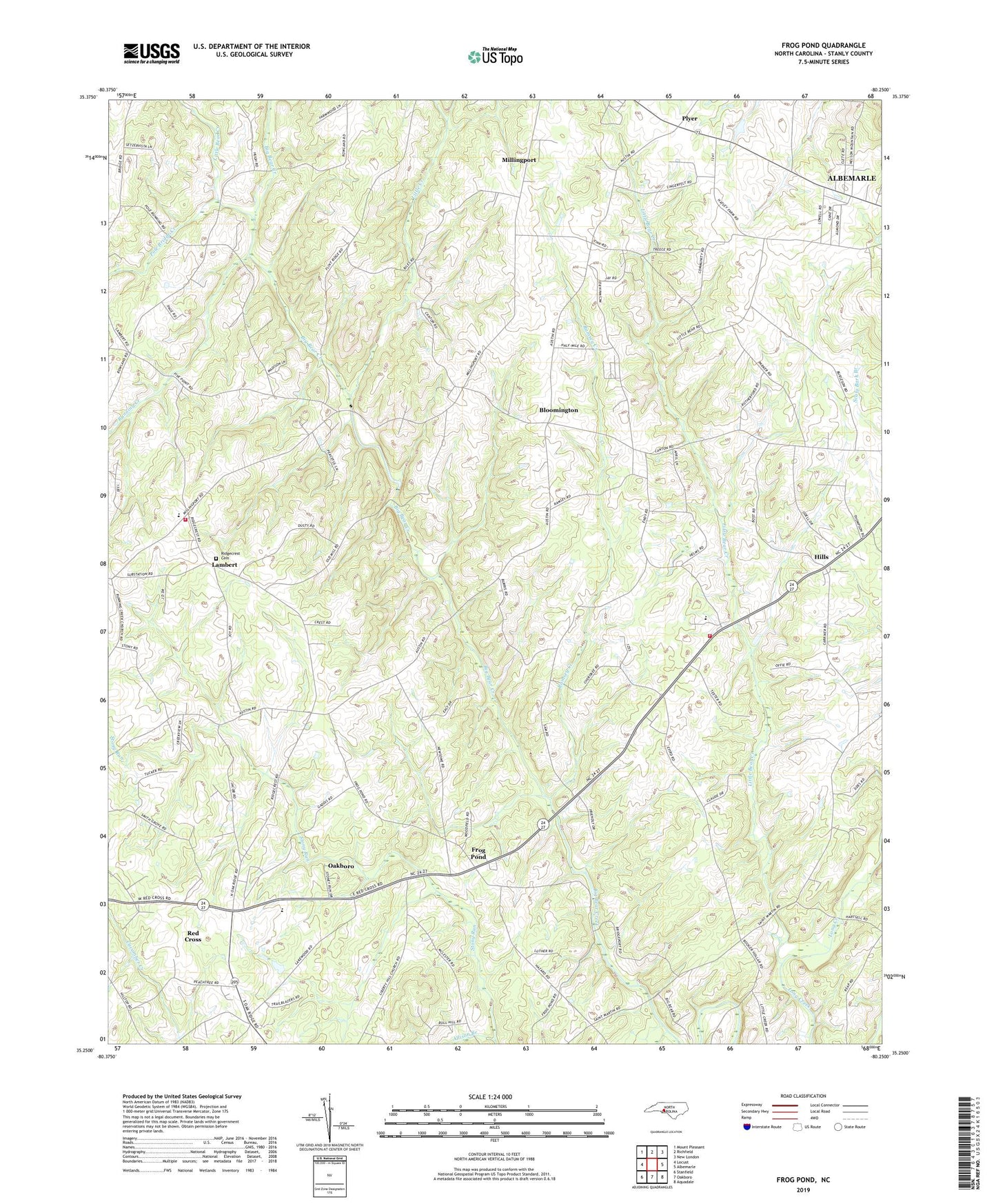
2019 topographic map quadrangle Frog Pond in the state of North Carolina. Scale: 1:24000. Based on the newly updated USGS 7.5' US Topo map series, this map is in the following counties: Stanly. The map contains contour data, water features, and other items you are used to seeing on USGS maps, but also has updated roads and other features. This is the next generation of topographic maps. Printed on high-quality waterproof paper with UV fade-resistant inks.
Quads adjacent to this one:
West: Locust
Northwest: Mount Pleasant
North: Richfield
Northeast: New London
East: Albemarle
Southeast: Aquadale
South: Oakboro
Southwest: Stanfield
Contains the following named places: Allison Branch, Bear Creek Church, Bloomington, Canton Church, Efirds Mill, Endy, Endy School, Endy Volunteer Fire Department, Frog Pond, Hills, Lakeside, Lambert, Liberty Hill Church, Little Bear Creek, Little Creek, New Life Church, Pleasant Grove Church, Plyer, Pole Bridge Creek, Ramsey Creek, Red Cross, Ridgecrest Cemetery, Ridgecrest Church, Ridgecrest School, Ridgecrest Volunteer Fire Department Station 36, Running Creek, Running Creek Church, Saint Martin, Saint Martins Church, Stanly County, Stanly County Emergency Medical Services Base 3, Stony Run, Town of Red Cross, Township of Almond, Township of Endy, Township School, West Stanly High School, Whitley Mill