MyTopo
Locust North Carolina US Topo Map
Couldn't load pickup availability
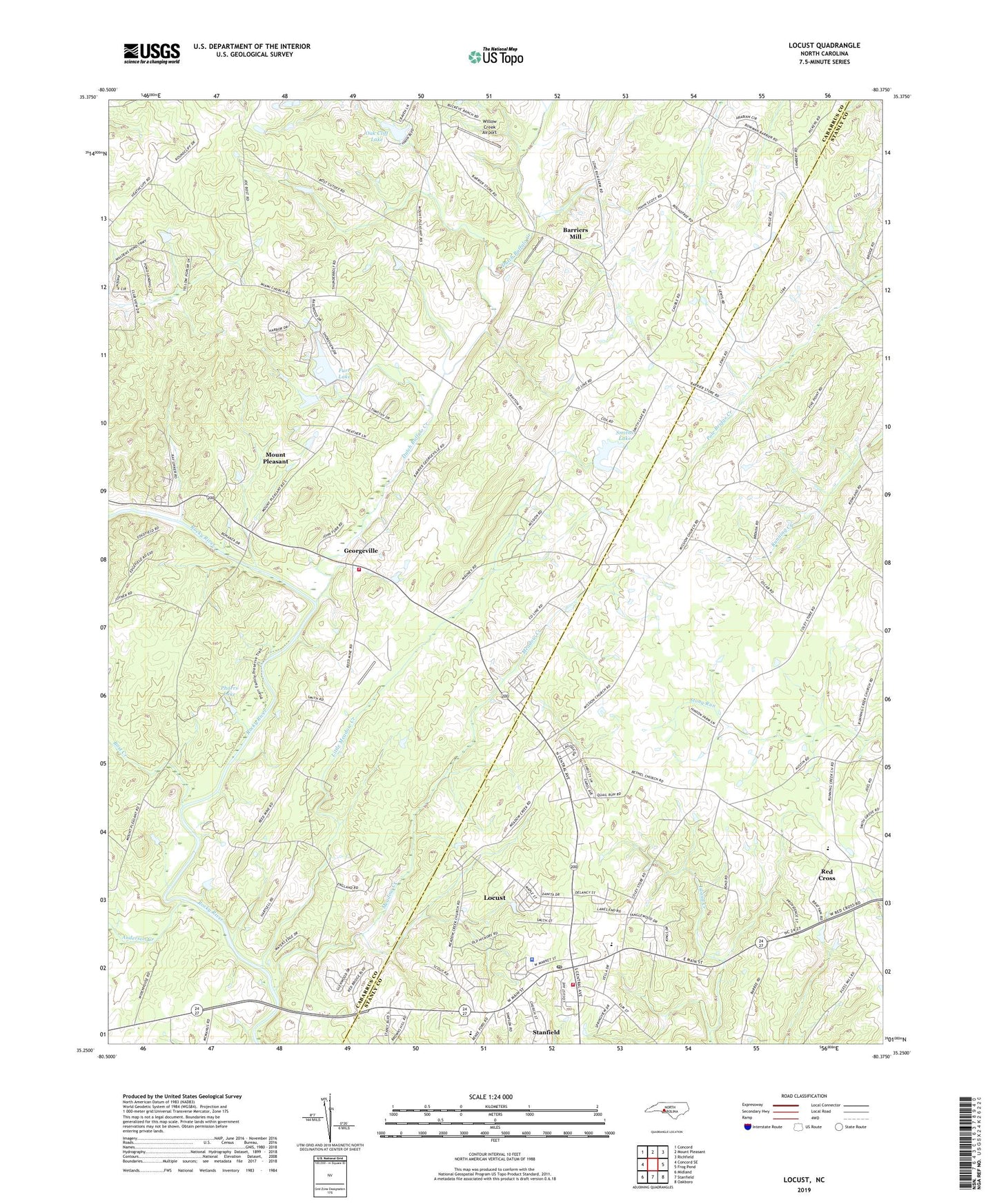
2022 topographic map quadrangle Locust in the state of North Carolina. Scale: 1:24000. Based on the newly updated USGS 7.5' US Topo map series, this map is in the following counties: Cabarrus, Stanly. The map contains contour data, water features, and other items you are used to seeing on USGS maps, but also has updated roads and other features. This is the next generation of topographic maps. Printed on high-quality waterproof paper with UV fade-resistant inks.
Quads adjacent to this one:
West: Concord SE
Northwest: Concord
North: Mount Pleasant
Northeast: Richfield
East: Frog Pond
Southeast: Oakboro
South: Stanfield
Southwest: Midland
This map covers the same area as the classic USGS quad with code o35080c4.
Contains the following named places: Anderson Creek, Barriers Mill, Bethel Church, Bost Creek, Bosts Mill, Brown Hill Church, Carolina Church, Center Grove Church, City of Locust, Community Church, Dutch Buffalo Creek, Flat Woods, Friendship Church, Furr Lake, Furr Lake Dam, Furrs, Garmons, Georgeville, Georgeville Volunteer Fire Department, Herrins Grove Church, Little Meadow Creek, Locust, Locust Police Department, Locust Post Office, Locust School, Meadow Creek, Meadow Creek Church, Miami Church, Mission Church, Oak Cliff Lake, Oak Cliff Lake Dam, Oak Cliffs, Oak Grove Church, Pharrs Lake, Pharrs Lake Dam, Pine Bluff Church, Providence Church, Reed Gold Mine, Reed Mine Airport, Rocky Ridge Church, Saint Martins Church, Saint Stephens Church, Smiths Lake, Smiths Lake Dam, Stephens Church, Township 9-Georgeville, West Stanly Fire Department, Willow Creek Airport, Wolf Pit Airport, ZIP Code: 28097