MyTopo
Oakboro North Carolina US Topo Map
Couldn't load pickup availability
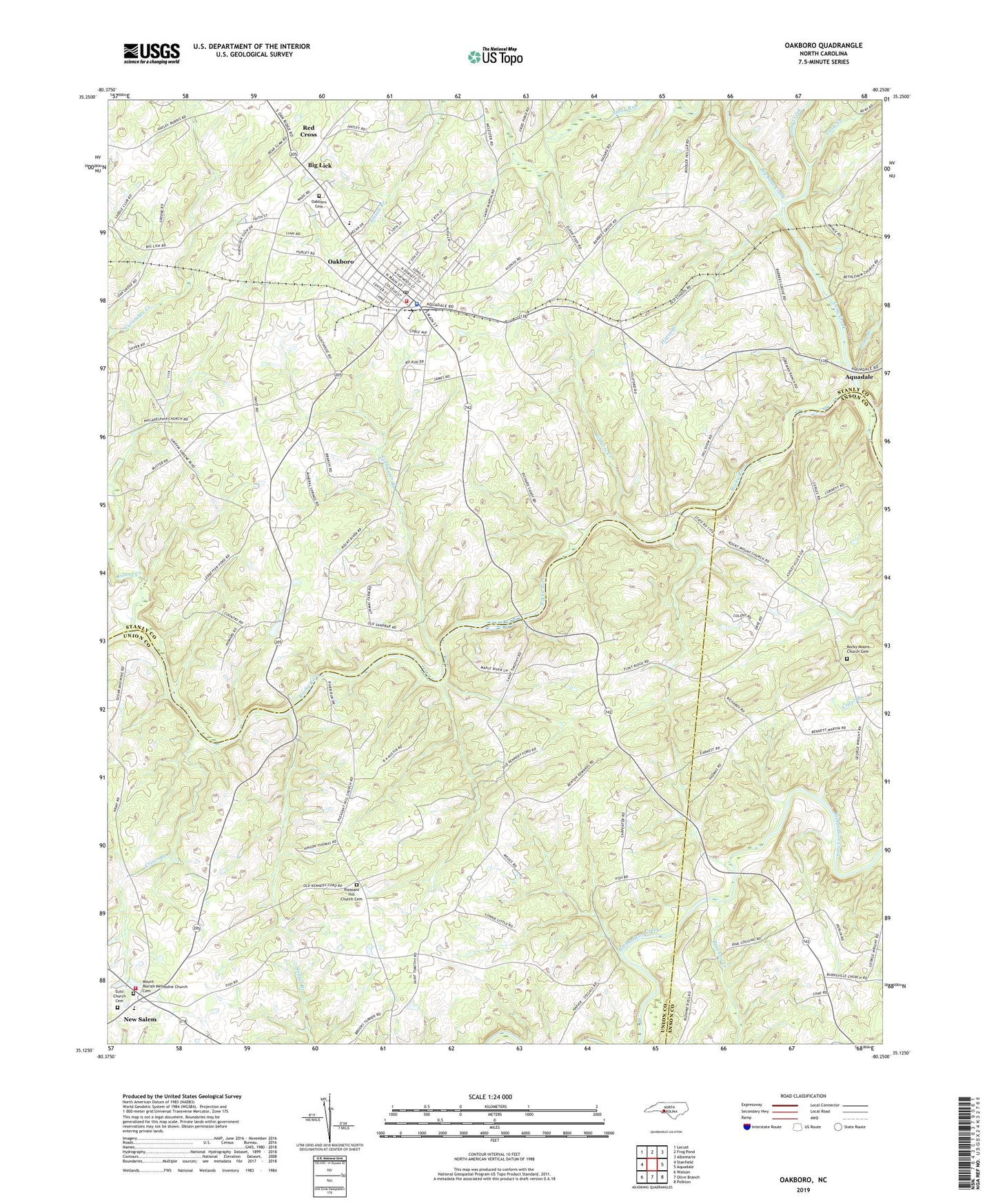
2022 topographic map quadrangle Oakboro in the state of North Carolina. Scale: 1:24000. Based on the newly updated USGS 7.5' US Topo map series, this map is in the following counties: Stanly, Union, Anson. The map contains contour data, water features, and other items you are used to seeing on USGS maps, but also has updated roads and other features. This is the next generation of topographic maps. Printed on high-quality waterproof paper with UV fade-resistant inks.
Quads adjacent to this one:
West: Stanfield
Northwest: Locust
North: Frog Pond
Northeast: Albemarle
East: Aquadale
Southeast: Polkton
South: Olive Branch
Southwest: Watson
This map covers the same area as the classic USGS quad with code o35080b3.
Contains the following named places: Barbee Church, Big Bear Creek, Big Lick, Coldwater Branch, Crisco Branch, Euto Church, Euto Church Cemetery, Ford, Gilberts Creek, Hatley Grove Church, Horse Branch, Island Creek, Little Creek, Long Branch, Long Creek, Mineral Springs Church, Mount Moriah Church, Mount Moriah Methodist Church Cemetery, Murray Branch, New Salem, New Salem Volunteer Fire Department Station 4, Oakboro, Oakboro Cemetery, Oakboro Fire and Rescue, Oakboro Police Department, Oakboro Post Office, Oakboro School, Pine Log Creek, Pleasant Hill Church Cemetery, Rocky Mount Church, Rocky Mount Church Cemetery, Smith Grove Church, Town of Oakboro, Township of Big Lick, West Oakboro Church, ZIP Code: 28129