MyTopo
Green Level North Carolina US Topo Map
Couldn't load pickup availability
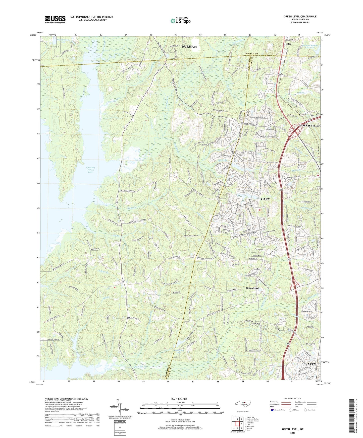
2019 topographic map quadrangle Green Level in the state of North Carolina. Scale: 1:24000. Based on the newly updated USGS 7.5' US Topo map series, this map is in the following counties: Chatham, Wake, Durham. The map contains contour data, water features, and other items you are used to seeing on USGS maps, but also has updated roads and other features. This is the next generation of topographic maps. Printed on high-quality waterproof paper with UV fade-resistant inks.
Quads adjacent to this one:
West: Farrington
Northwest: Chapel Hill
North: Southwest Durham
Northeast: Southeast Durham
East: Cary
Southeast: Apex
South: New Hill
Southwest: Merry Oaks
Contains the following named places: Bachelor Branch, Bay Meadows Lake, Bay Meadows Lake Dam, Cary Fire Department Station 7, Cary Fire Department Station 8, Castlebury Lake, Castlebury Lake Dam, Clark Branch, Crooked Creek, Durham Wildlife Club Lake, Durham Wildlife Club Lake Dam, Genlee, Green Level, Holland Chapel, Indian Creek, Jack Branch, Kellys Store, Kit Creek, Lick Branch, Little Creek, Long Branch, Marthas Chapel United Church of Christ, Mill Branch, Morgan Creek, Morris Branch, Morrisville Fire and Rescue Department Station 3, Mount Pisgah Missionary Baptist Church, Nancy Branch, New Hope Church, New Hope Creek, Northeast Creek, O'Kellys Church, Panther Creek, Research Triangle State Park, Rocky Ford Branch, Township of White Oak, White Oak Church, ZIP Codes: 27519, 27523