MyTopo
Hoffman North Carolina US Topo Map
Couldn't load pickup availability
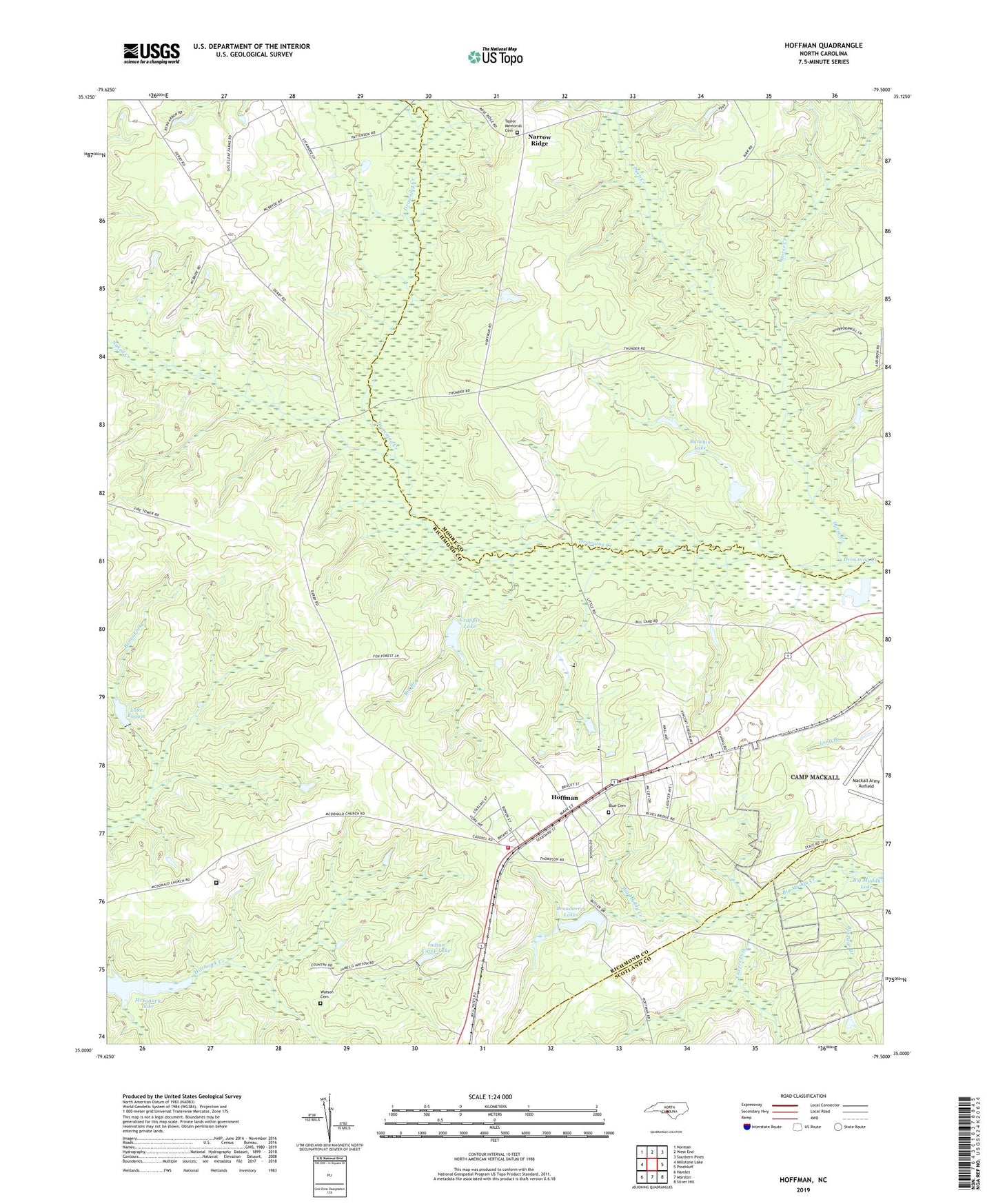
2022 topographic map quadrangle Hoffman in the state of North Carolina. Scale: 1:24000. Based on the newly updated USGS 7.5' US Topo map series, this map is in the following counties: Richmond, Moore, Scotland. The map contains contour data, water features, and other items you are used to seeing on USGS maps, but also has updated roads and other features. This is the next generation of topographic maps. Printed on high-quality waterproof paper with UV fade-resistant inks.
Quads adjacent to this one:
West: Millstone Lake
Northwest: Norman
North: West End
Northeast: Southern Pines
East: Pinebluff
Southeast: Silver Hill
South: Marston
Southwest: Hamlet
This map covers the same area as the classic USGS quad with code o35079a5.
Contains the following named places: Big Bear Branch, Big Branch, Blue Cemetery, Broadacres Lake, Broadacres Lake Dam, Broadacres Lakes, Crappie Lake, Crappie Lake Dam, Deep Creek, Fletcher Chapel, Hoffman, Hoffman Baptist Church, Hoffman Elementary School, Hoffman Fire and Rescue, Hoffman High School, Hoffman Methodist Episcopal Church, Horse Creek, Indian Camp Lake, Indian Camp Park, Lake Bagget, Long Branch, Macedonia Church, Mackall Army Airfield, McKinney Lake, McKinney Lake National Fish Hatchery, McNir Chapel, Morrison Correctional Institution, Morrison Training School, Naked Creek, Narrow Ridge, New Bethel Church, Ocre Grove Church, P R Rankin Dam, Ranchin Lake, Saint Johns Church, Taylor Baptist Church Memorial Cemetery, Taylor Memorial Church, Towers Fork, Town of Hoffman, Township of Beaverdam, Watson Cemetery