MyTopo
Kannapolis North Carolina US Topo Map
Couldn't load pickup availability
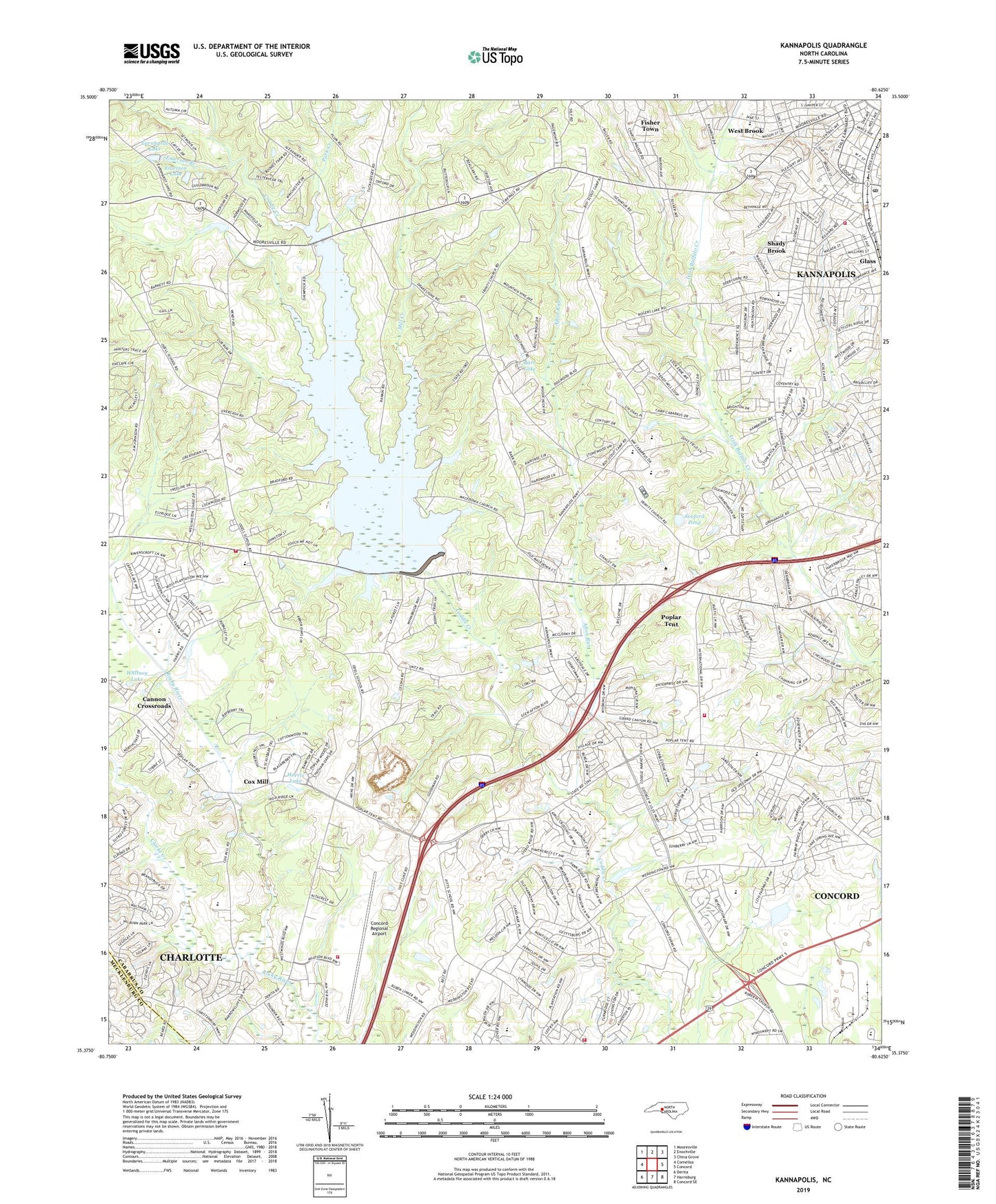
2019 topographic map quadrangle Kannapolis in the state of North Carolina. Scale: 1:24000. Based on the newly updated USGS 7.5' US Topo map series, this map is in the following counties: Cabarrus, Mecklenburg. The map contains contour data, water features, and other items you are used to seeing on USGS maps, but also has updated roads and other features. This is the next generation of topographic maps. Printed on high-quality waterproof paper with UV fade-resistant inks.
Quads adjacent to this one:
West: Cornelius
Northwest: Mooresville
North: Enochville
Northeast: China Grove
East: Concord
Southeast: Concord SE
South: Harrisburg
Southwest: Derita
Contains the following named places: Afton Run, Barr Lake, Baycock School, Bethany Church, Bethpage Church, Bethpage School, Cabarrus Country Club, Cabarrus Country Club Lake Dam Number One, Cabarrus Country Club Lake Number One, Cabarrus County Emergency Medical Services Station 4, Cabarrus County Emergency Medical Services Station 5, Cabarrus County Emergency Medical Services Station 7, Camp Cabarrus, Cannon Crossroads, Cedar Grove Church, Cedar Grove School, City of Concord, City of Kannapolis, Clarke Creek, Coddle Creek, Concord Fire and Life Safety Station 6, Concord Fire and Life Safety Station 7, Concord Fire Department Station 5, Concord-Padgett Regional Airport, Cox Mill, Deweese, Earnhardt Lake, Earnhardt Lake Dam, Emerson Branch, Emerson Lake, Emerson Lake Dam, Evans College, Fisher Town, Gilwood Church, Glass, Harris Lake, Holly Grove Church, International Business Park, Kannapolis Fire Department Station 2, Kannapolis Post Office, Kannapolis Township 4, Macedonia Church, McIver School, Meadow View School, Mill Creek, Mill Hill, Mount Zion Church, Odell Church, Odell High School, Odell Volunteer Fire and Rescue, Park Creek, Pitts Chapel, Pleasant Grove Church, Pleasant Grove School, Poplar Grove Church, Poplar Tent, Poplar Tent Church, Rock Hill Church, Seaford Pond, Seaford Pond Dam, Shady Brook, Shady Brook School, Shady Grove Chapel, Shiloh Church, Springsville, Township 2-Poplar Tent, Township 3-Odell, Trinity Church, Tulin, West Brook, Whitney Lake, ZIP Code: 28027