MyTopo
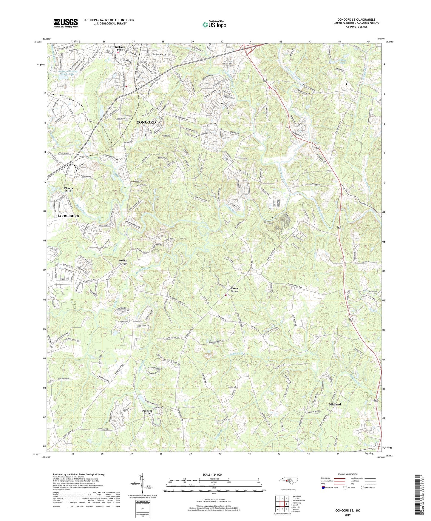
Concord SE North Carolina US Topo Map
Couldn't load pickup availability
2022 topographic map quadrangle Concord SE in the state of North Carolina. Scale: 1:24000. Based on the newly updated USGS 7.5' US Topo map series, this map is in the following counties: Cabarrus. The map contains contour data, water features, and other items you are used to seeing on USGS maps, but also has updated roads and other features. This is the next generation of topographic maps. Printed on high-quality waterproof paper with UV fade-resistant inks.
Quads adjacent to this one:
West: Harrisburg
Northwest: Kannapolis
North: Concord
Northeast: Mount Pleasant
East: Locust
Southeast: Stanfield
South: Midland
Southwest: Mint Hill
This map covers the same area as the classic USGS quad with code o35080c5.
Contains the following named places: Allen School, Allen Volunteer Fire Department, Back Creek, Benton School, Bethany Church, Bogers Chapel, Cabarrus County Emergency Medical Services Station 2, Caldwell Creek, Carrikers Store, Cedar Grove Church, Central Cabarrus High School, Coddle Creek, Cold Water Creek, Collins Pond, Concord Fire and Life Safety Station 8, Ebenezer Church, Ebenezer School, Faggarts Crossroads, Flowes Store Volunteer Fire Department, Flows Store, Frank Liske Park, Hamby Branch, Horton Branch, Howell Church, Irish Buffalo Creek, Jackson Park Volunteer Fire Department, Jackson Training School, Jackson Training School Lake, Jackson Training School Lake Dam, Kirkland, Mount Hermon Church, Oak Ridge Church, Pharrs Mill, Pine Grove Church, Piney Grove Church, Pioneer Mills, Plum Run, Reedy Creek, Reeves Chapel, Rocky Ridge Church, Rocky River, Rocky River Church, Township 10 Midland, Township 11-Central Cabarrus, Township 1-Harrisburg, United Church, Zion Hill Church, ZIP Code: 28107