
MyTopo
Kellum North Carolina US Topo Map
Couldn't load pickup availability
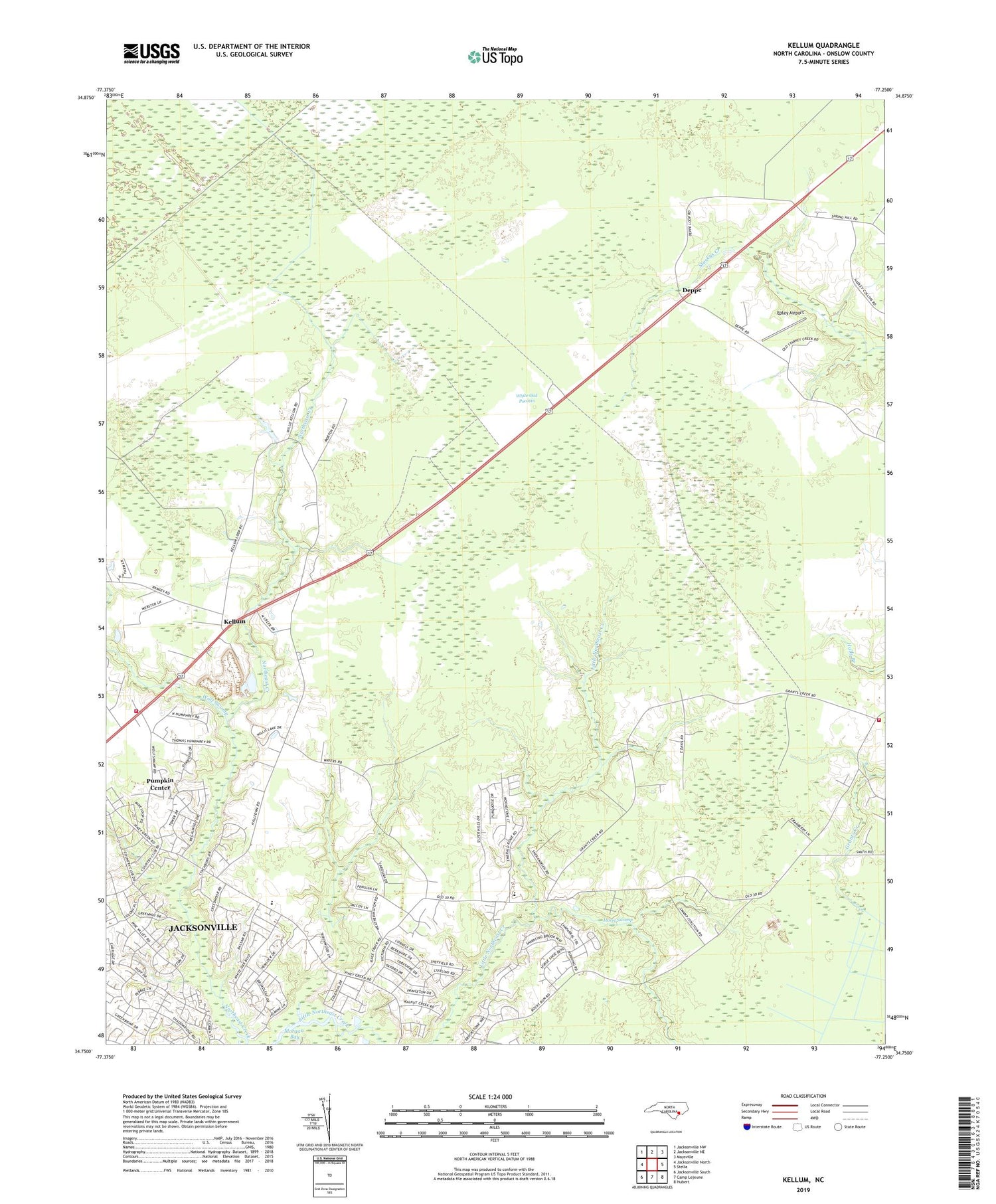
2019 topographic map quadrangle Kellum in the state of North Carolina. Scale: 1:24000. Based on the newly updated USGS 7.5' US Topo map series, this map is in the following counties: Onslow. The map contains contour data, water features, and other items you are used to seeing on USGS maps, but also has updated roads and other features. This is the next generation of topographic maps. Printed on high-quality waterproof paper with UV fade-resistant inks.
Quads adjacent to this one:
West: Jacksonville North
Northwest: Jacksonville NW
North: Jacksonville NE
Northeast: Maysville
East: Stella
Southeast: Hubert
South: Camp Lejeune
Southwest: Jacksonville South
Contains the following named places: Aragona Village, Birchwood Park, Carolina Country, Centerview Baptist Church, Colonial Hills, Country Club Acres, Country Club Estates, Country Club Hills, Deppe, Deppe Landing Strip, Emmanuel Church, Epley Airport, Faith Church, Fountain of Life Church, Grants Creek Church, Hubert Volunteer Fire Department White Oak Sub - Station, Humphrey, Kellum, Kellum Baptist Church, Montclair, Morton School, Mortons Cross Road, New Life Baptist Church, New Wine Christian Worship Center, Oakwood, Pine Hill, Pumpkin Center, Pumpkin Center Census Designated Place, Pumpkin Center Volunteer Fire Department, Township of White Oak, Walnut Creek, Wetherington's Mobile Home Park, White Oak Airport, White Oak Estates, White Oak High School, Wolf Swamp, ZIP Code: 28546


