MyTopo
Stella North Carolina US Topo Map
Couldn't load pickup availability
Also explore the Stella Forest Service Topo of this same quad for updated USFS data
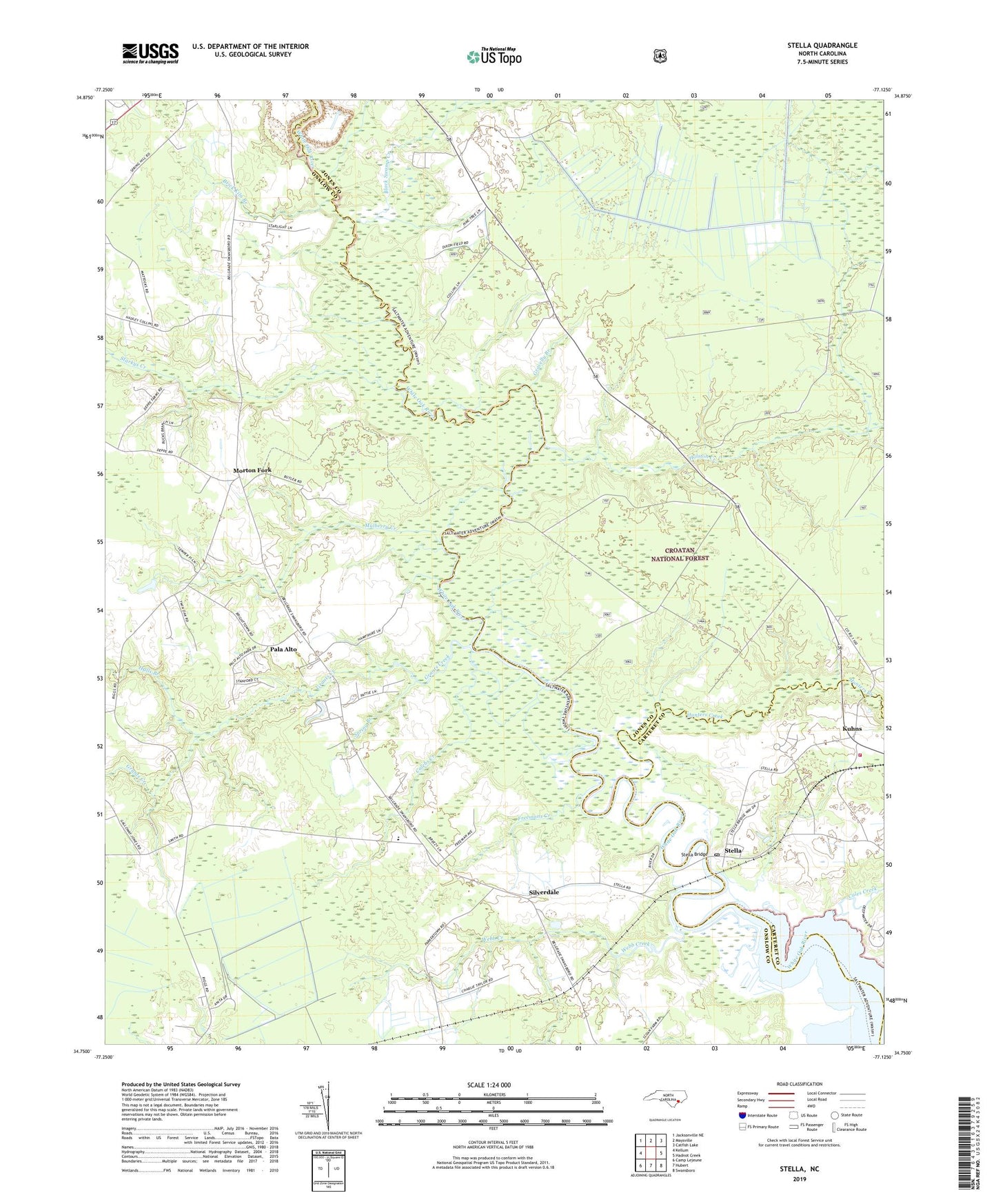
2022 topographic map quadrangle Stella in the state of North Carolina. Scale: 1:24000. Based on the newly updated USGS 7.5' US Topo map series, this map is in the following counties: Onslow, Jones, Carteret. The map contains contour data, water features, and other items you are used to seeing on USGS maps, but also has updated roads and other features. This is the next generation of topographic maps. Printed on high-quality waterproof paper with UV fade-resistant inks.
Quads adjacent to this one:
West: Kellum
Northwest: Jacksonville NE
North: Maysville
Northeast: Catfish Lake
East: Hadnot Creek
Southeast: Swansboro
South: Hubert
Southwest: Camp Lejeune
This map covers the same area as the classic USGS quad with code o34077g2.
Contains the following named places: Black Swamp Creek, Brick Kiln Branch, Bryans Mobile Home Park, Calebs Creek, Cales Creek, Davis Chapel, Fowle Post Office, Freemans Creek, Grants Creek, Gravelly Branch, Halls Branch, Haywood Landing Recreation Site, Holston Creek, Hopewell Church, Hunters Creek, Kuhns, Longpoint Landing, Midway Church, Morton Fork, Mulberry Creek, Pala Alto, Saint James Church, Saint Paul Church, Saint Stephen Church, Saint Stephens Church, Silverdaale School, Silverdale, Spring Branch, Starkys Creek, Stella, Stella Bridge, Stella Post Office, Stella Volunteer Fire Department, Tabernacle Church, Tabernacle School, Webb Creek, White Oak School, ZIP Code: 28555