MyTopo
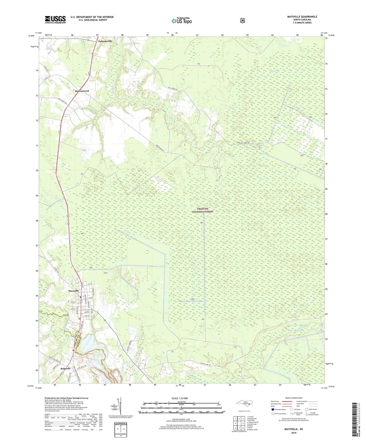
Maysville North Carolina US Topo Map
Couldn't load pickup availability
Also explore the Maysville Forest Service Topo of this same quad for updated USFS data
2022 topographic map quadrangle Maysville in the state of North Carolina. Scale: 1:24000. Based on the newly updated USGS 7.5' US Topo map series, this map is in the following counties: Jones, Onslow. The map contains contour data, water features, and other items you are used to seeing on USGS maps, but also has updated roads and other features. This is the next generation of topographic maps. Printed on high-quality waterproof paper with UV fade-resistant inks.
Quads adjacent to this one:
West: Jacksonville NE
Northwest: Trenton
North: Pollocksville
Northeast: New Bern
East: Catfish Lake
Southeast: Hadnot Creek
South: Stella
Southwest: Kellum
This map covers the same area as the classic USGS quad with code o34077h2.
Contains the following named places: Belgrade, Belgrade Quarry, Belgrade Volunteer Fire Department, Black Swamp Fire Tower, Catfish Lake South Wilderness, Catfish Lake Waterfowl Impoundment, Chadwick, Lees Methodist Chapel, Maysville, Maysville Methodist Church, Maysville Police Department, Maysville Post Office, Maysville Volunteer Fire Department and Emergency Medical Services, Maysville Wastewater Treatment Plant, Memorial Church, Mirey Branch, Ravenswood, Saint Phillip Church, Town of Maysville, Township 1-White Oak, White Oak Church, Zions Chapel, ZIP Code: 28573