MyTopo
Kure Beach North Carolina US Topo Map
Couldn't load pickup availability
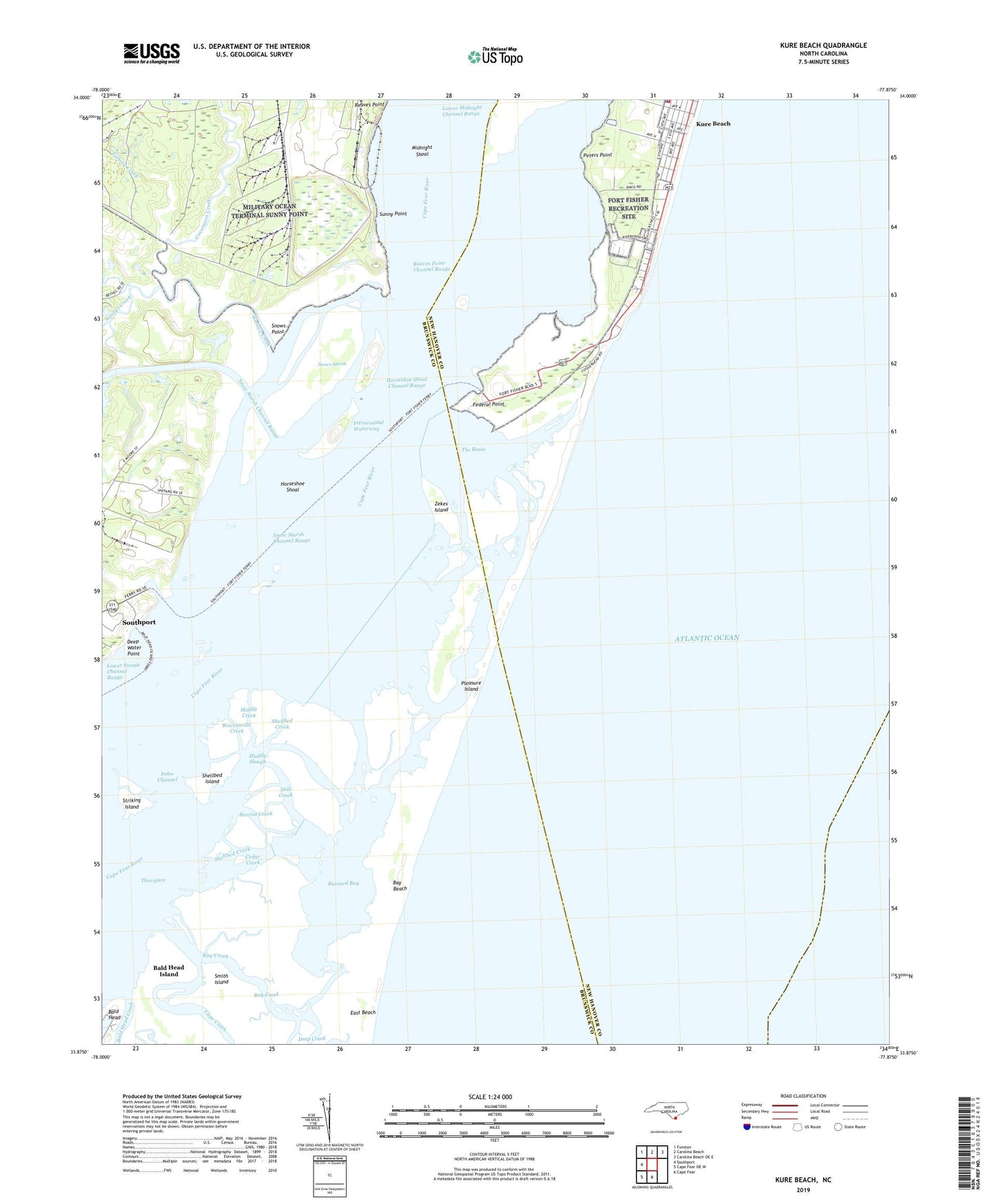
2019 topographic map quadrangle Kure Beach in the state of North Carolina. Scale: 1:24000. Based on the newly updated USGS 7.5' US Topo map series, this map is in the following counties: Brunswick, New Hanover. The map contains contour data, water features, and other items you are used to seeing on USGS maps, but also has updated roads and other features. This is the next generation of topographic maps. Printed on high-quality waterproof paper with UV fade-resistant inks.
Quads adjacent to this one:
West: Southport
Northwest: Funston
North: Carolina Beach
Northeast: Carolina Beach OE E
South: Cape Fear
Southwest: Cape Fear OE W
Contains the following named places: Bald Head Creek, Bay Beach, Bay Creek, Bowensville Creek, Burriss Creek, Buzzard Bay, Cape Creek, Cedar Creek, Corncake Inlet, Deep Water Point, False Channel, Federal Point, Fishing Creek, Fort Fisher State Historic Site, Fort Fisher State Recreation Area, Governors Creek, Gum Log Branch, Horseshoe Shoal, Horseshoe Shoal Channel Range, Kure Beach, Kure Beach Police Department, Kure Beach Wastewater Treatment Plant, Lower Midnight Channel Range, Middle Creek, Midnight Shoal, Muddy Slough, Nancys Creek, New Inlet, Nigis Creek, North Carolina Aquarium at Fort Fisher, Peters Point, Price Creek, Prices Creek Lighthouse, Reaves Point Channel Range, Sheephead Rock, Shellbed Creek, Shellbed Island, Smith Island, Snow Marsh Channel Range, Snows Marsh, Snows Point, Still Creek, Striking Island, Sunny Point, The Basin, The Rocks, Thorofare, Town of Kure Beach, Walden Creek, Zekes Island, ZIP Code: 28449