MyTopo
Funston North Carolina US Topo Map
Couldn't load pickup availability
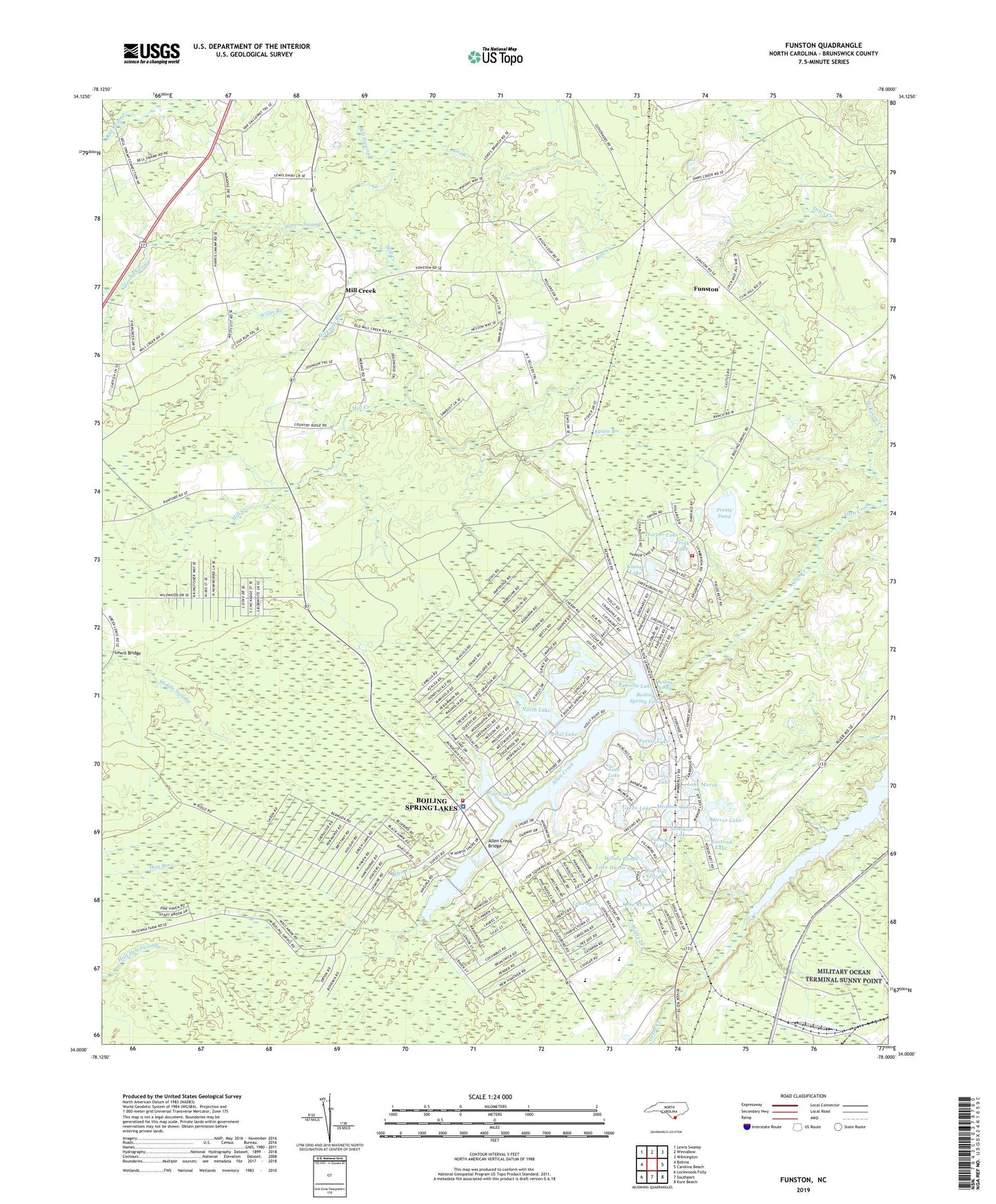
2022 topographic map quadrangle Funston in the state of North Carolina. Scale: 1:24000. Based on the newly updated USGS 7.5' US Topo map series, this map is in the following counties: Brunswick. The map contains contour data, water features, and other items you are used to seeing on USGS maps, but also has updated roads and other features. This is the next generation of topographic maps. Printed on high-quality waterproof paper with UV fade-resistant inks.
Quads adjacent to this one:
West: Bolivia
Northwest: Lewis Swamp
North: Winnabow
Northeast: Wilmington
East: Carolina Beach
Southeast: Kure Beach
South: Southport
Southwest: Lockwoods Folly
This map covers the same area as the classic USGS quad with code o34078a1.
Contains the following named places: Allen Creek Bridge, Bell Swamp, Blue Gill Pond, Boiling Spring, Boiling Spring Lake, Boiling Spring Lake Dam, Boiling Spring Lakes, Boiling Spring Lakes Police Department, Boiling Spring Lakes Volunteer Fire Department Station 1, Boiling Spring Lakes Volunteer Fire Department Station 2, Boiling Spring Lakes Volunteer Fire Department Station 3, Brunswick County Emergency Medical Services, Brunswick Station, Christian Chapel, City of Boiling Spring Lakes, Crystal Lake, Eastend Lake, Forest Lake, Frink Lake, Funston, Green Lake, Harper Lake, Harris Swamp, Hickman Branch, Kaziah Lake, Lake Buis, Lake Hastie, Lake Marsh, Lake Middleton, Lake Reaves, Lebanon Church, Lewis Bridge, Meadow Lake, Military Ocean Terminal Sunny Point, Mill Creek, Mill Creek Church, Mirror Lake, Moore Creek, New Hope Church, North Lake, North Lake Dam, Paradise Lake, Patricia Lake, Peace Memorial Church, Pine Lake, Pine Lake Dam, Pretty Pond, Rice Creek, Seminole Lake, Shadow Lake, Silver Lake, South Brunswick High School, South Brunswick Middle School, Spring Lake, Swain Branch, Tate Lake, Twin Lakes, Willet Branch, Woods Ponds, ZIP Code: 28479