MyTopo
Marston North Carolina US Topo Map
Couldn't load pickup availability
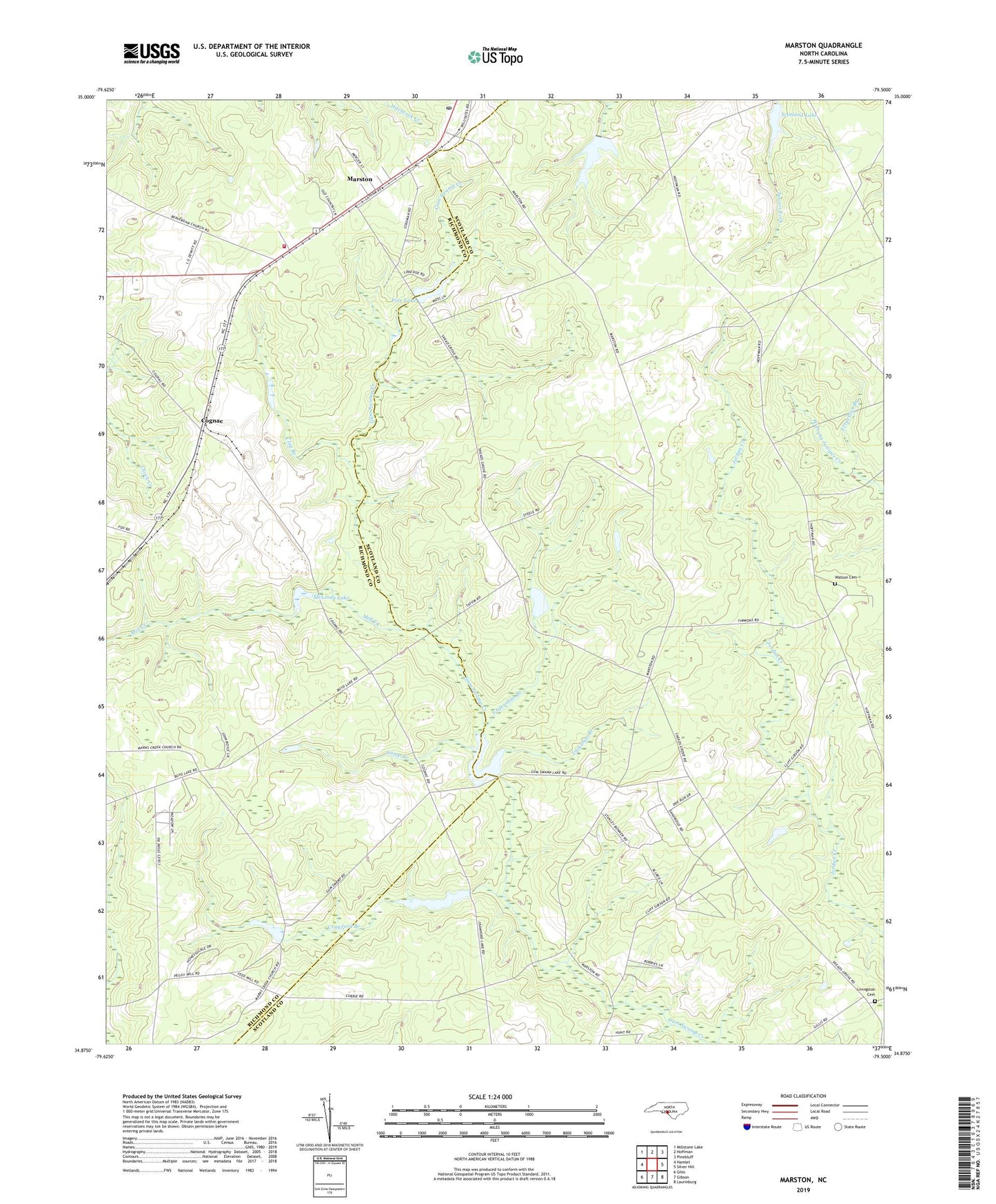
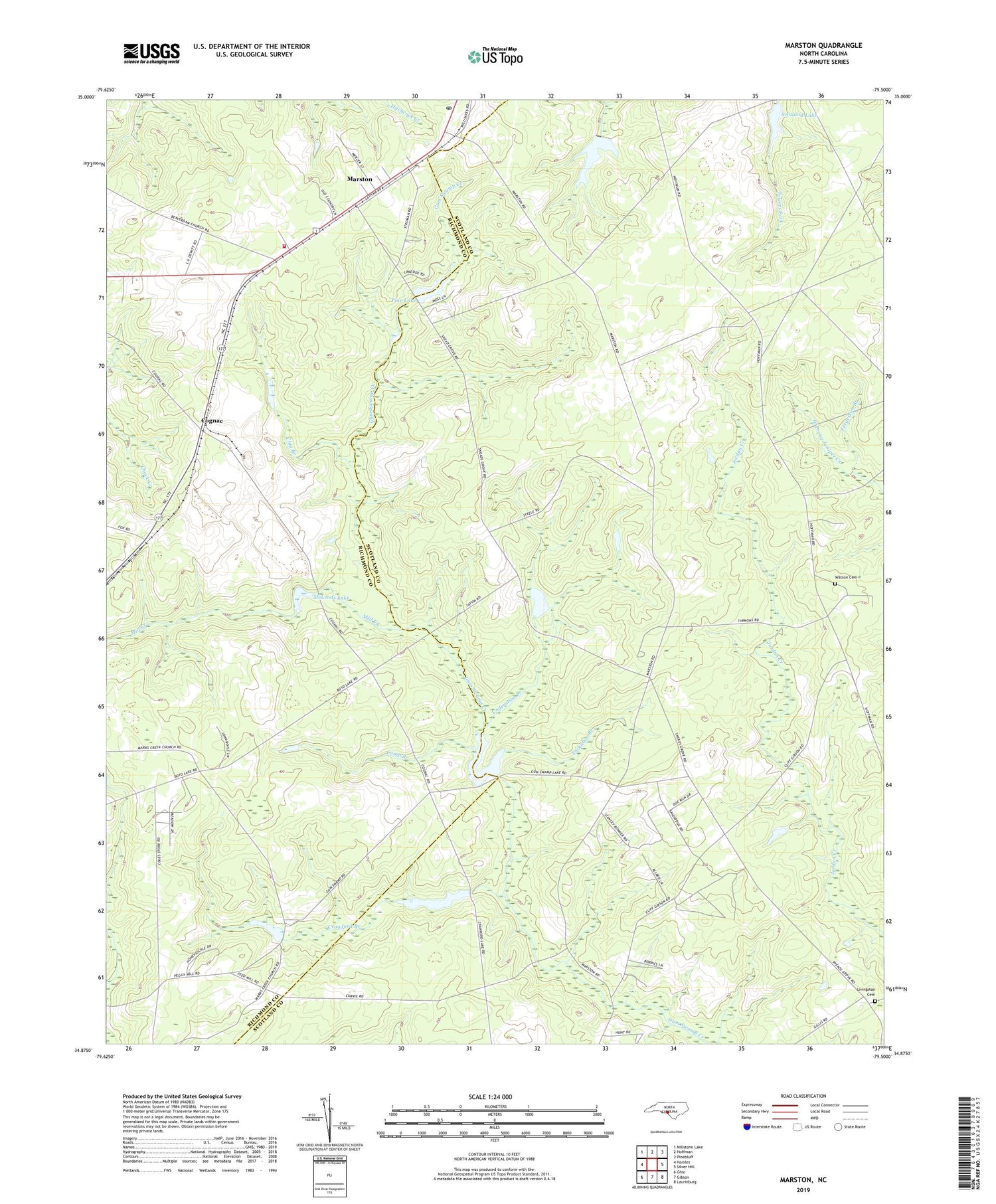
2019 topographic map quadrangle Marston in the state of North Carolina. Scale: 1:24000. Based on the newly updated USGS 7.5' US Topo map series, this map is in the following counties: Scotland, Richmond. The map contains contour data, water features, and other items you are used to seeing on USGS maps, but also has updated roads and other features. This is the next generation of topographic maps. Printed on high-quality waterproof paper with UV fade-resistant inks.
Quads adjacent to this one:
West: Hamlet
Northwest: Millstone Lake
North: Hoffman
Northeast: Pinebluff
East: Silver Hill
Southeast: Laurinburg
South: Gibson
Southwest: Ghio
Contains the following named places: Camerons Lake, Camp Branch, Carolina Silica Mine, Catawba Lake, Clay Branch, Cognac, Cognac Post Office, Crawford Branch, Crawford Lake, Crawford Lake Dam, Fergerson Branch, Good Hope Church, Gum Swamp Lake, Gum Swamp Lake Dam, Hoffman Fire Department and Rescue Squad Station 2, Hoffman Post Office, Kinney Cameron Lake Dam, Laurel Hill Dam, Livingston Cemetery, Marston, Marston Poultry Farm, McLeods Lake, Mill Creek, Pine Lake, Pine Lake Dam, Scotland Lake, Scotland Lake Dam, Smiths Grove Church, Timmons Grove Church, Township of Laurel Hill, Tuckahoe Branch, Undermine Branch, Watson Cemetery, ZIP Code: 28363