MyTopo
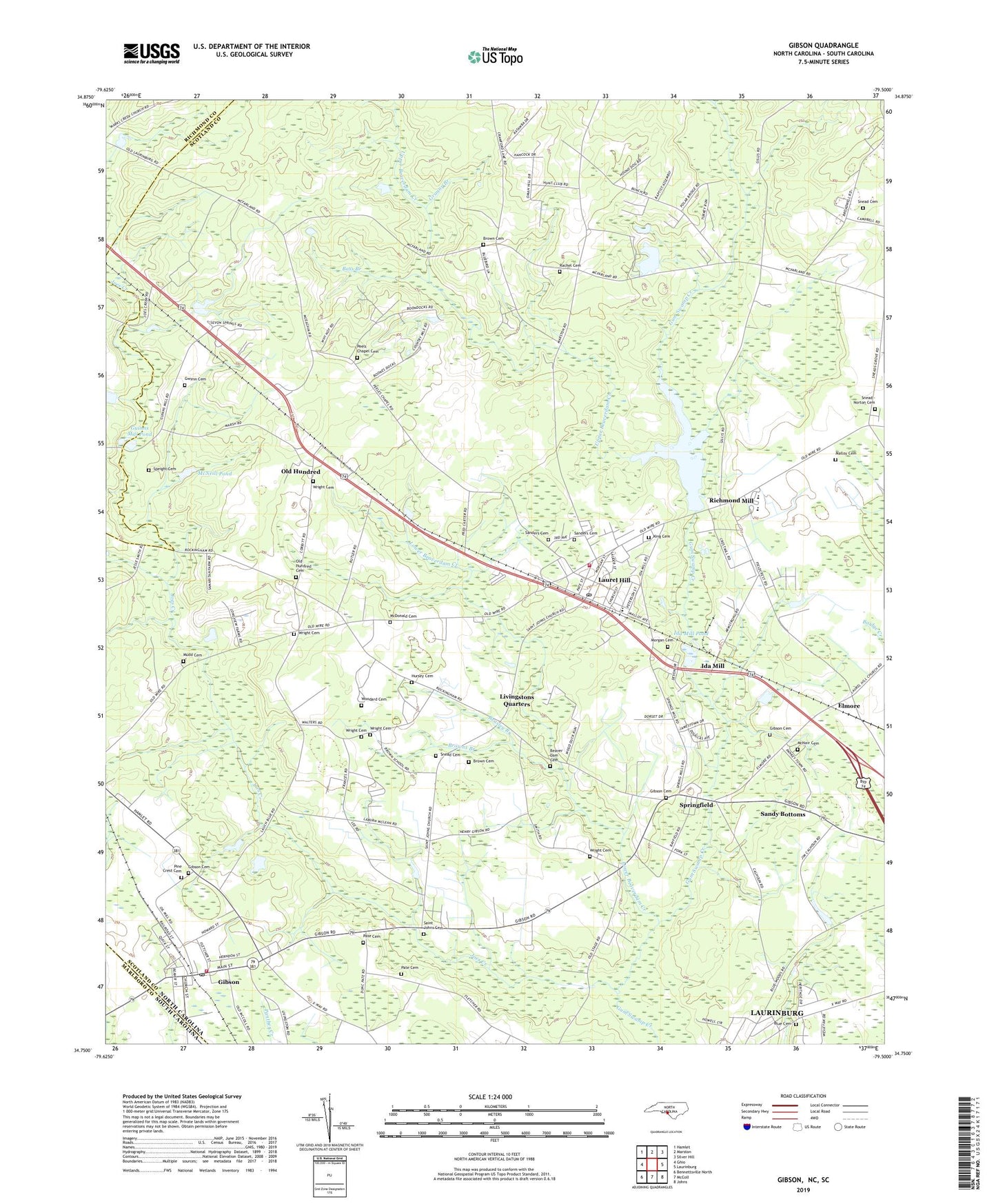
Gibson North Carolina US Topo Map
Couldn't load pickup availability
2022 topographic map quadrangle Gibson in the state of North Carolina. Scale: 1:24000. Based on the newly updated USGS 7.5' US Topo map series, this map is in the following counties: Scotland, Richmond, Marlboro. The map contains contour data, water features, and other items you are used to seeing on USGS maps, but also has updated roads and other features. This is the next generation of topographic maps. Printed on high-quality waterproof paper with UV fade-resistant inks.
Quads adjacent to this one:
West: Ghio
Northwest: Hamlet
North: Marston
Northeast: Silver Hill
East: Laurinburg
Southeast: Johns
South: McColl
Southwest: Bennettsville North
Contains the following named places: Allen Chapel, Bass Branch, Baysville Church, Baysville School, Beasley Branch, Beaver Dam Cemetery, Beaverdam Church, Blue Cemetery, Brown Cemetery, Browns Branch, Cameron Grove School, Carver Middle School, Cedar Church, Church of God, Elmore, Elmore Crossroads, Gibson, Gibson Cemetery, Gibson Post Office, Gibson School, Gibson Southwest District Fire Department, Granny Branch, Guinns Mill Pond, Gwynn Cemetery, Holiness Church, Hursey Cemetery, Ida Mill, Ida Mill Pond, Joes Creek, King Cemetery, Lakeside Chapel, Laurel Hill, Laurel Hill Census Designated Place, Laurel Hill Elementary School, Laurel Hill Fire Department, Laurel Hill Post Office, Livingstons Quarters, Lower Beaverdam Creek, Malloy Cemetery, McDonald Cemetery, McNair Cemetery, McNeill Pond, Morgan Cemetery, Mudd Cemetery, Old Hundred, Old Hundred Cemetery, Old Hundred Census Designated Place, Old Hundred School, Pate Cemetery, Pate Gardner Elementary School, Peel Chapel, Peels Chapel Cemetery, Pine Crest Cemetery, Rachel Cemetery, Rachel Church, Richmond Mill, Richmond Mill Lake, Richmond Mill Pond Dam, Saint Johns Cemetery, Saint Johns Church, Saint Marys Church, Sanders Cemetery, Sandy Bottoms, Snead - Norton Cemetery, Snead Cemetery, Sneads Grove Church, Sneads Grove School, Speight Cemetery, Springfield, Springfield Church, Town of Gibson, Township of Williamson, Upper Beaverdam Creek, WEWO-AM (Laurinburg), WLNC-AM (Laurinburg), Woodard Cemetery, Wright Cemetery, Wrights Branch Church, ZIP Codes: 28343, 28351


