MyTopo
Middletown North Carolina US Topo Map
Couldn't load pickup availability
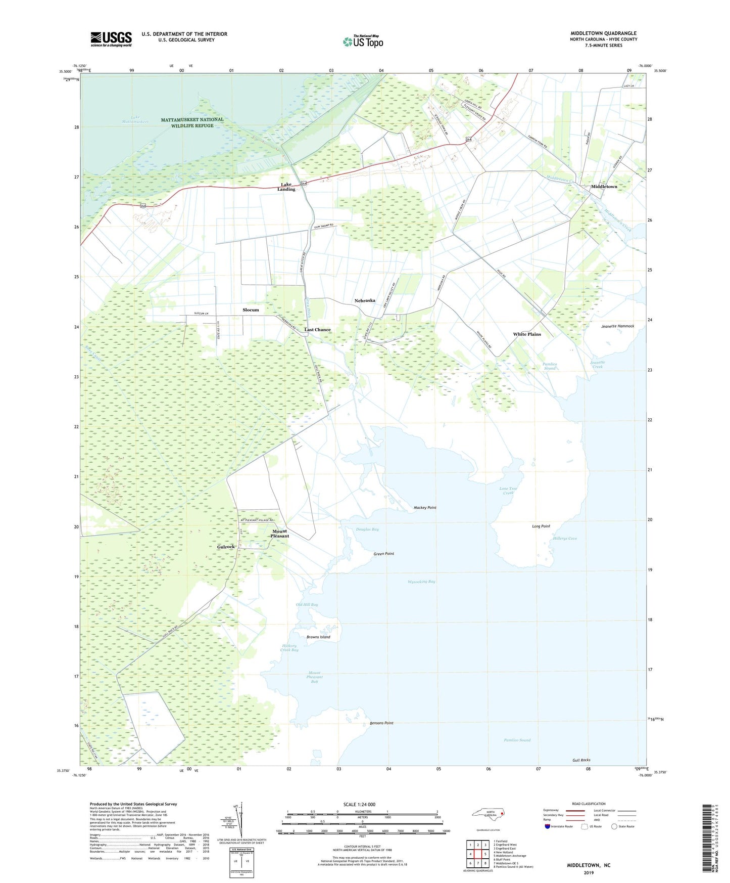
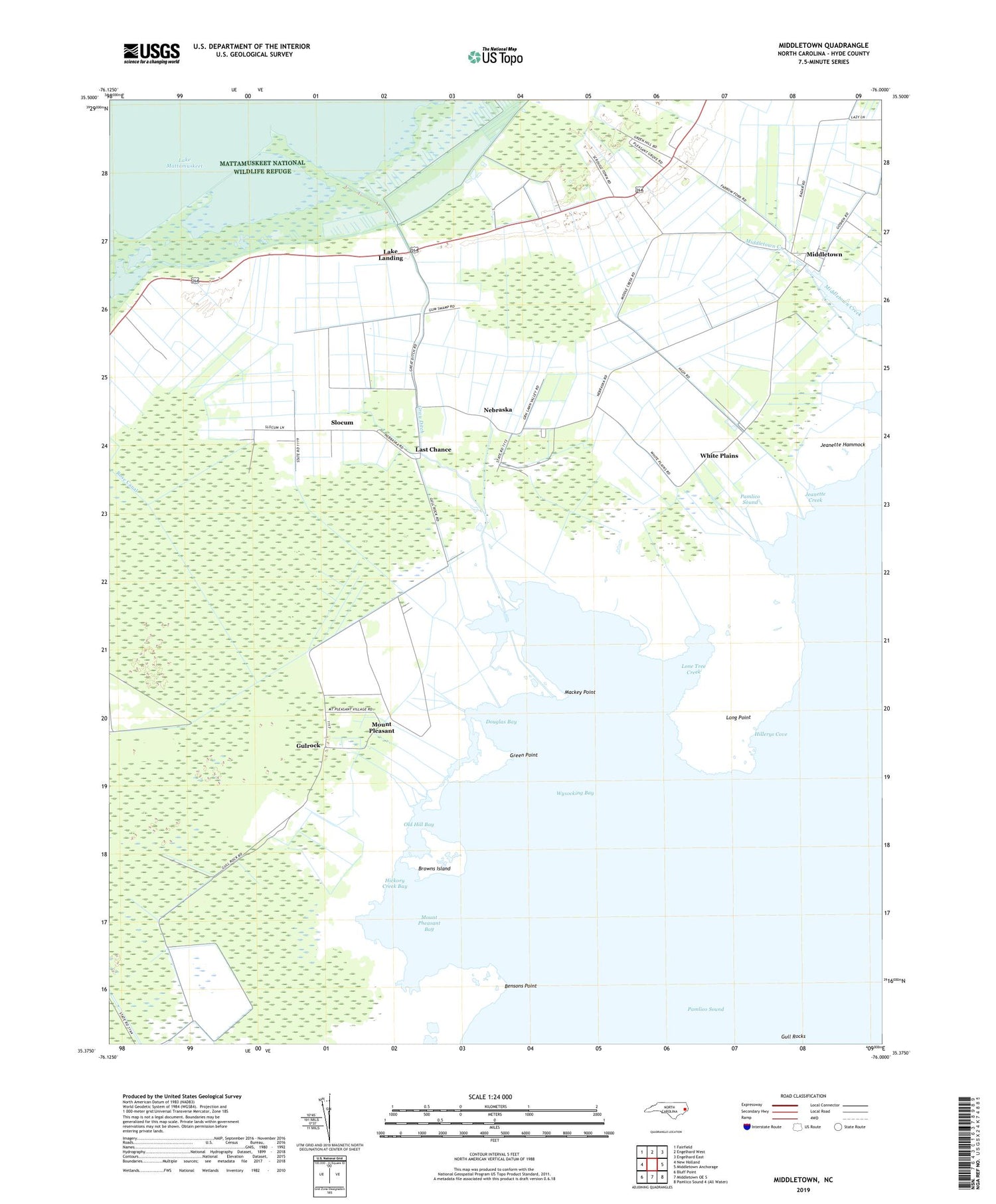
2019 topographic map quadrangle Middletown in the state of North Carolina. Scale: 1:24000. Based on the newly updated USGS 7.5' US Topo map series, this map is in the following counties: Hyde. The map contains contour data, water features, and other items you are used to seeing on USGS maps, but also has updated roads and other features. This is the next generation of topographic maps. Printed on high-quality waterproof paper with UV fade-resistant inks.
Quads adjacent to this one:
West: New Holland
Northwest: Fairfield
North: Engelhard West
Northeast: Engelhard East
East: Middletown Anchorage
South: Middletown OE S
Southwest: Bluff Point
Contains the following named places: Amity Church, Bensons Point, Brooks Creek, Browns Island, Douglas Bay, Feds Creek, Gray Ditch, Green Point, Gull Rocks, Gulrock, Hickory Creek, Hickory Creek Bay, Hillerys Cove, Jeanette Creek, Jeanette Hammock, Lake Landing, Last Chance, Lone Tree Creek, Long Point, Mackey Point, Middletown, Mount Pheasant Bay, Mount Pleasant, Nebraska, Old Hill Bay, Pleasant Grove Church, Rose Canal, Slocum, White Plains, Wysocking Bay