MyTopo
New Holland North Carolina US Topo Map
Couldn't load pickup availability
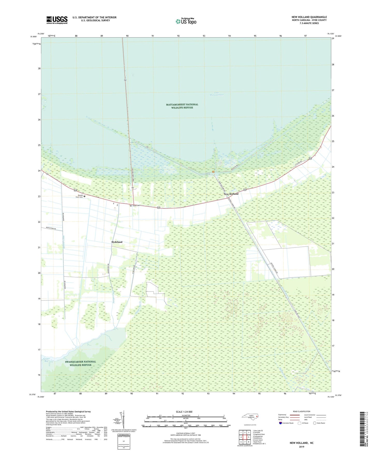
2022 topographic map quadrangle New Holland in the state of North Carolina. Scale: 1:24000. Based on the newly updated USGS 7.5' US Topo map series, this map is in the following counties: Hyde. The map contains contour data, water features, and other items you are used to seeing on USGS maps, but also has updated roads and other features. This is the next generation of topographic maps. Printed on high-quality waterproof paper with UV fade-resistant inks.
Quads adjacent to this one:
West: Swanquarter
Northwest: New Lake SE
North: Fairfield
Northeast: Engelhard West
East: Middletown
Southeast: Middletown OE S
South: Bluff Point
Southwest: Great Island
This map covers the same area as the classic USGS quad with code o35076d2.
Contains the following named places: Aramuskeet, Aromuskek Marshes, Donald Farm Cemetery, Hyde County, Hydeland, Hydeland Canal, Judges Quarter, Juniper Bay Creek, Juniper Canal, Lake Comfort, Mattamuskeet High School, Mattamuskeet National Wildlife Refuge Headquarters, New Holland, New Holland School, Northwest Creek, Old Richmond Church, Outfall Canal, Quarter Canal, Saint Mary Church, Soule Cemetery, Soule Church, The Bluff, WHYC-FM (Swan Quarter)