MyTopo
Mintonsville North Carolina US Topo Map
Couldn't load pickup availability
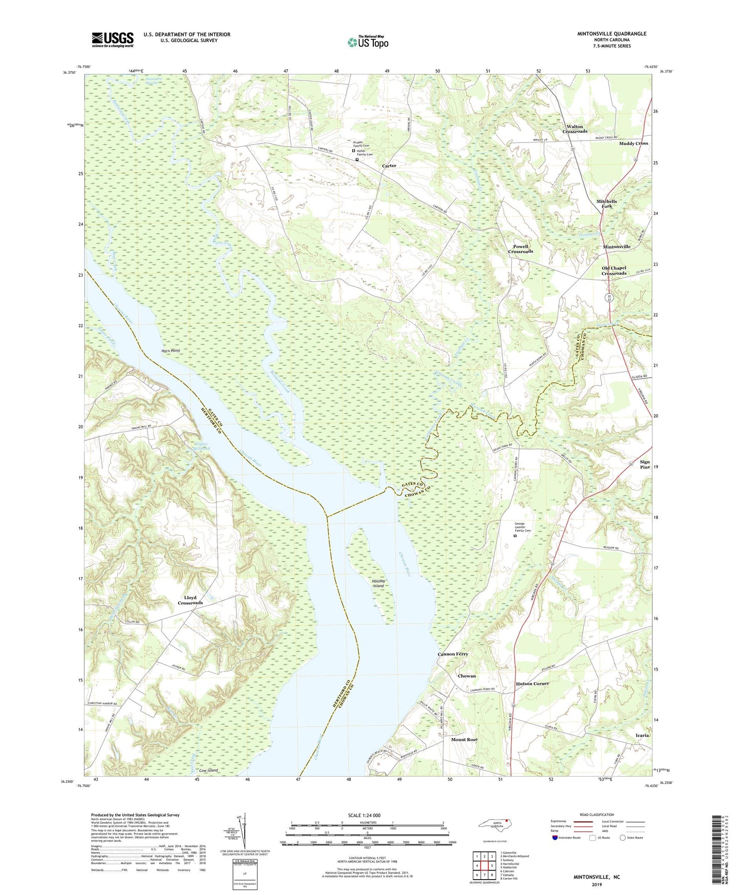
2019 topographic map quadrangle Mintonsville in the state of North Carolina. Scale: 1:24000. Based on the newly updated USGS 7.5' US Topo map series, this map is in the following counties: Gates, Chowan, Hertford. The map contains contour data, water features, and other items you are used to seeing on USGS maps, but also has updated roads and other features. This is the next generation of topographic maps. Printed on high-quality waterproof paper with UV fade-resistant inks.
Quads adjacent to this one:
West: Harrellsville
Northwest: Gatesville
North: Merchants Millpond
Northeast: Sunbury
East: Hobbsville
Southeast: Center Hill
South: Valhalla
Southwest: Colerain
Contains the following named places: Beef Creek, Bennetts Creek, Bond Landing, Cannon Ferry, Carter, Catherine Creek, Chowan, Christian Harbor Church, Deep Swamp Branch, Dinkerderry Landing, Dogwood Landing, Fletchers Chapel, George Lassiter Family Cemetery, Goose Creek, Hofler Family Cemetery, Holiday Island, Honey Pot Swamp, Horn Point, Hurdle Landing, Hutson Corner, Icaria, Indian Old Field, Lloyd Crossroads, Mintonsville, Mitchells Fork, Mount Pleasant Wharf, Mount Rose, Muddy Cross, Old Chapel Crossroads, Oldtown Landing, Powell Crossroads, Pruden Family Cemetery, Roberts Landing, Ryland, Stumpy Creek, Taylor Millpond, Taylor Wharf, The Harbor, Township 3-Upper, Township of Mintonsville, Trotman Creek, Walton Crossroads, Walton Grove Church, Warwick Church, Warwick Creek, Welchs Chapel, Welsh Pond, Woodleys Wharf