MyTopo
Center Hill North Carolina US Topo Map
Couldn't load pickup availability
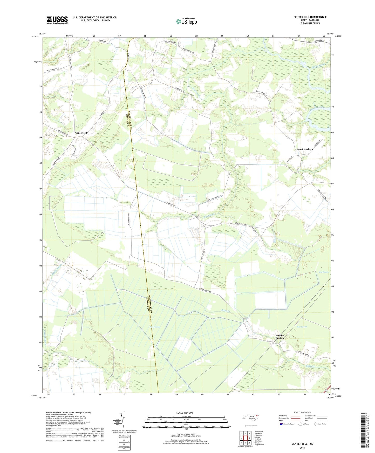
2022 topographic map quadrangle Center Hill in the state of North Carolina. Scale: 1:24000. Based on the newly updated USGS 7.5' US Topo map series, this map is in the following counties: Perquimans, Chowan. The map contains contour data, water features, and other items you are used to seeing on USGS maps, but also has updated roads and other features. This is the next generation of topographic maps. Printed on high-quality waterproof paper with UV fade-resistant inks.
Quads adjacent to this one:
West: Valhalla
Northwest: Mintonsville
North: Hobbsville
Northeast: Chapanoke
East: Hertford
Southeast: Yeopim River
South: Edenton
Southwest: Edenhouse
This map covers the same area as the classic USGS quad with code o36076b5.
Contains the following named places: Anderson Church, Bagley Swamp, Beach Springs, Bear Swamp, Center Hill, Chowan County, Dwight, Goodings Millpond, Goodwin Creek, Great Hope Church, Happy Home Church, Hunters Fork Church, Piney Grove Church, Saunders Grove Church, Township of Hertford, Tyner Post Office, Yeopim Station, ZIP Code: 27980