MyTopo
Gatesville North Carolina US Topo Map
Couldn't load pickup availability
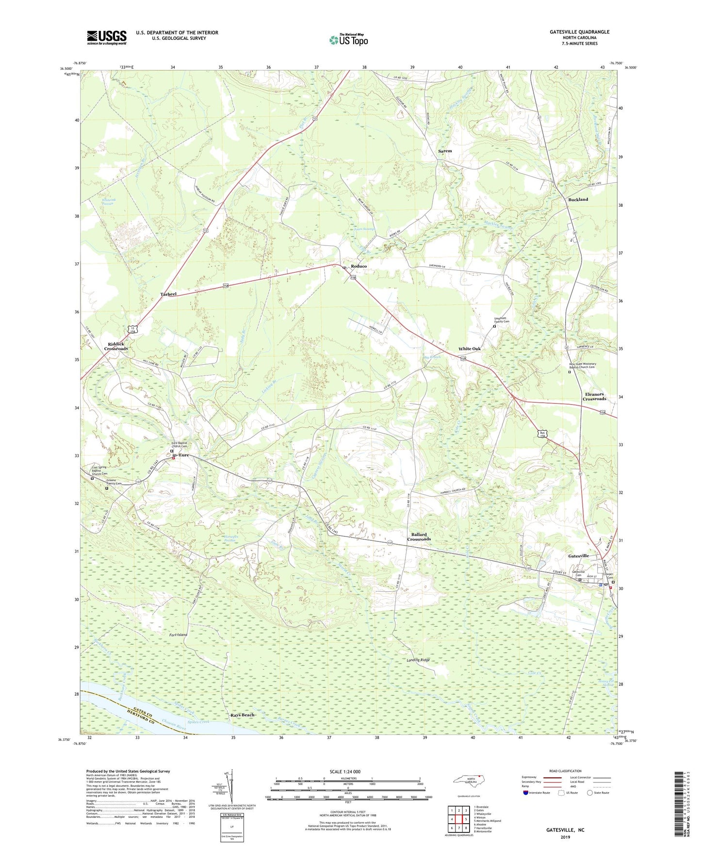
2022 topographic map quadrangle Gatesville in the state of North Carolina. Scale: 1:24000. Based on the newly updated USGS 7.5' US Topo map series, this map is in the following counties: Gates, Hertford. The map contains contour data, water features, and other items you are used to seeing on USGS maps, but also has updated roads and other features. This is the next generation of topographic maps. Printed on high-quality waterproof paper with UV fade-resistant inks.
Quads adjacent to this one:
West: Winton
Northwest: Riverdale
North: Gates
Northeast: Whaleyville
East: Merchants Millpond
Southeast: Mintonsville
South: Harrellsville
Southwest: Ahoskie
This map covers the same area as the classic USGS quad with code o36076d7.
Contains the following named places: Ballard Crossroads, Ballards Grove Church, Big Branch, Buckhorn Creek, Buckland, Buckland Mill Branch, Buckland School, Cole Creek, Cool Spring Baptist Church Cemetery, Cool Spring Church, Cowper Cemetery, Cypress Swamp, Ebenezer Gospel Church, Eleanors Crossroads, Eure, Eure Baptist Church Cemetery, Eure Church, Eure Post Office, Eure Volunteer Fire Department, Farm Fresh Shopping Center, Flat Branch, Fort Island, Gates County Sheriff's Office, Gatesville, Gatesville Cemetery, Gatesville Elementary School, Gatesville Post Office, Gatesville Volunteer Fire Department, Greene Family Cemetery, Gum Branch, Hackley Swamp, Harrell Church, Horsepen Pocosin, Jady Branch, Jones Swamps, Kittrells Church, Landing Ridge, Licking Branch, Lillys Millpond, New Hope Church, New Hope Missionary Baptist Church Cemetery, Rays Beach, Riddick Crossroads, Roduco, Roduco Post Office, Sarem, Sarem Grove Church, Spices Creek, Spikes Creek, Tarheel, Taylor Millpond, Town of Gatesville, Township of Hall, Umphlett Family Cemetery, White Oak, Whiteoak Pocosin, ZIP Code: 27935