MyTopo
Moffitt Hill North Carolina US Topo Map
Couldn't load pickup availability
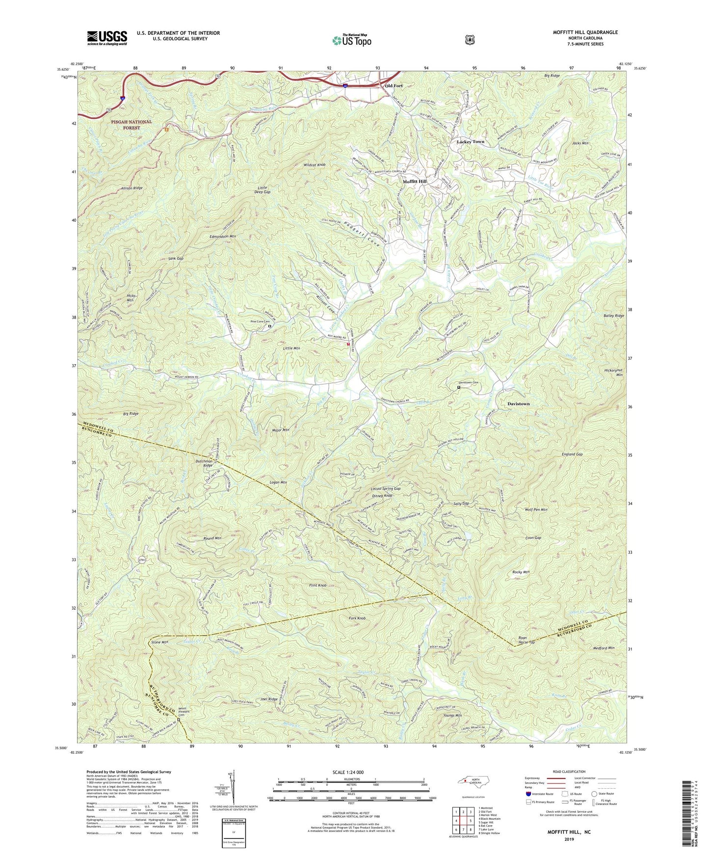
2019 topographic map quadrangle Moffitt Hill in the state of North Carolina. Scale: 1:24000. Based on the newly updated USGS 7.5' US Topo map series, this map is in the following counties: McDowell, Rutherford, Buncombe. The map contains contour data, water features, and other items you are used to seeing on USGS maps, but also has updated roads and other features. This is the next generation of topographic maps. Printed on high-quality waterproof paper with UV fade-resistant inks.
Quads adjacent to this one:
West: Black Mountain
Northwest: Montreat
North: Old Fort
Northeast: Marion West
East: Sugar Hill
Southeast: Shingle Hollow
South: Lake Lure
Southwest: Bat Cave
Contains the following named places: Allison Cove, Bailey Creek, Bailey Ridge, Bear Gap, Bethel Church, Bethlehem Church, Big Branch, Big Ridge, Bird Creek, Bradley Creek, Camp Creek, Camp Elliott, Cane Branch, Catawba Falls Church, Cherry Springs Church, Chestnut Branch, Clarks Branch, Clover Patch Branch, Coon Gap, Crooked Creek Township Volunteer Fire Department, Davistown, Davistown Cemetery, Dill Branch, Ditney Knob, Dutchman Ridge, Edmondson Mountain, England Gap, Flint Knob, Fork Knob, Guthrie Branch, Hicks Mountain, Hodges Creek, Jacks Mountain, Jackson Creek, Jeter, Joel Ridge, Jordan Branch, Koon Branch, Lackey Town, Lake Lure Mountain Estates, Laurel Creek, Left Prong Catawba River, Little Crooked Creek, Little Deep Gap, Little Mountain, Locust Spring Gap, Logan Mountain, Long Branch, Loom Creek, Lytle Branch, Major Mountain, Medford Mountain, Mill Creek, Moffitt Hill, Mount Hebron Church, Mount Pleasant Cemetery, Padgett Cove, Pine Cove Branch, Pine Cove Cemetery, Roan Horse Top, Rocky Mountain, Rosy Branch, Round Mountain, Salem Church, Sally Branch, Sally Gap, Sank Gap, Spring Branch, Stone Mountain, Stone Mountain Church, Sunnyview Church, Taylor Creek, Township of Crooked Creek, Wash Branch, Wildcat Knob, Wolf Pen Mountain, Youngs Fork Creek