MyTopo
Shingle Hollow North Carolina US Topo Map
Couldn't load pickup availability
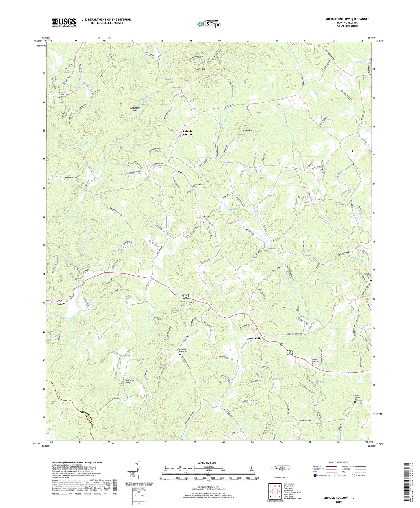
2022 topographic map quadrangle Shingle Hollow in the state of North Carolina. Scale: 1:24000. Based on the newly updated USGS 7.5' US Topo map series, this map is in the following counties: Rutherford, Polk. The map contains contour data, water features, and other items you are used to seeing on USGS maps, but also has updated roads and other features. This is the next generation of topographic maps. Printed on high-quality waterproof paper with UV fade-resistant inks.
Quads adjacent to this one:
West: Lake Lure
Northwest: Moffitt Hill
North: Sugar Hill
Northeast: Glenwood
East: Rutherfordton North
Southeast: Rutherfordton South
South: Pea Ridge
Southwest: Mill Spring
This map covers the same area as the classic USGS quad with code o35082d1.
Contains the following named places: Anderson Shoal, Antioch Church, Antioch Church Cemetery, Bills Creek, Brooks Lake Dam, Cedar Creek, Cedar Creek Church, Chapel Hill Church, Cove Creek, Cuba, East Branch Mountain Creek, Gage, Green Hill, Green Hill Baptist Church, Green Hill Cemetery, Green Hill Elementary School, Green Hill Volunteer Fire Department, Knob Creek, Lake Brooks, Mathews Church, Matthews Church Cemetery, Miller - Twitty Cemetery, Mountain Creek Cemetery, Mullin Bible Camp, Nanito, Nanney, Oak Ridge Church, Piney Creek, Piney Knob, Piney Knob Church, Piney Knob Creek, Pleasant Grove Baptist Church Cemetery, Pleasant Grove Church, Rutherford Power Plant, Shingle Hollow, Shingle Hollow Fire Department, Toms Mountain, Township of Green Hill, Township of Morgan, West Branch Mountain Creek, Whiteside Bridge, Youngs Creek