MyTopo
New Hill North Carolina US Topo Map
Couldn't load pickup availability
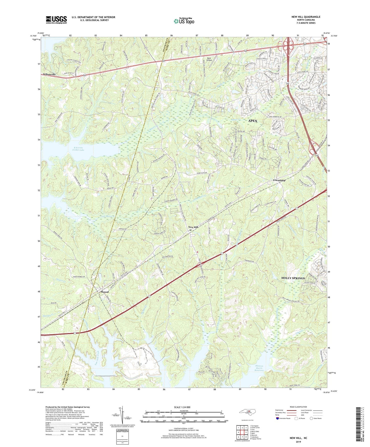
2019 topographic map quadrangle New Hill in the state of North Carolina. Scale: 1:24000. Based on the newly updated USGS 7.5' US Topo map series, this map is in the following counties: Wake, Chatham. The map contains contour data, water features, and other items you are used to seeing on USGS maps, but also has updated roads and other features. This is the next generation of topographic maps. Printed on high-quality waterproof paper with UV fade-resistant inks.
Quads adjacent to this one:
West: Merry Oaks
Northwest: Farrington
North: Green Level
Northeast: Cary
East: Apex
Southeast: Fuquay-Varina
South: Cokesbury
Southwest: Moncure
Contains the following named places: Apex Fire Department Station 2, Beaver Creek Commons Shopping Center, Big Branch, Bonsal, Cedar Rock Church, Christian Chapel, Clark and Sears Store, Deck Airpark, Friendship, Gerringer-Goodman Dam, Gerringer-Goodman Pond, Little Branch, Mount Zion Church, New Hill, New Hill Post Office, Oak Grove Church, Olive Chapel, Olive Chapel Elementary School, Pleasant Plains Church, Reedy Branch, Township of Buckhorn, Utley Creek, ZIP Codes: 27502, 27562