MyTopo
Niagara North Carolina US Topo Map
Couldn't load pickup availability
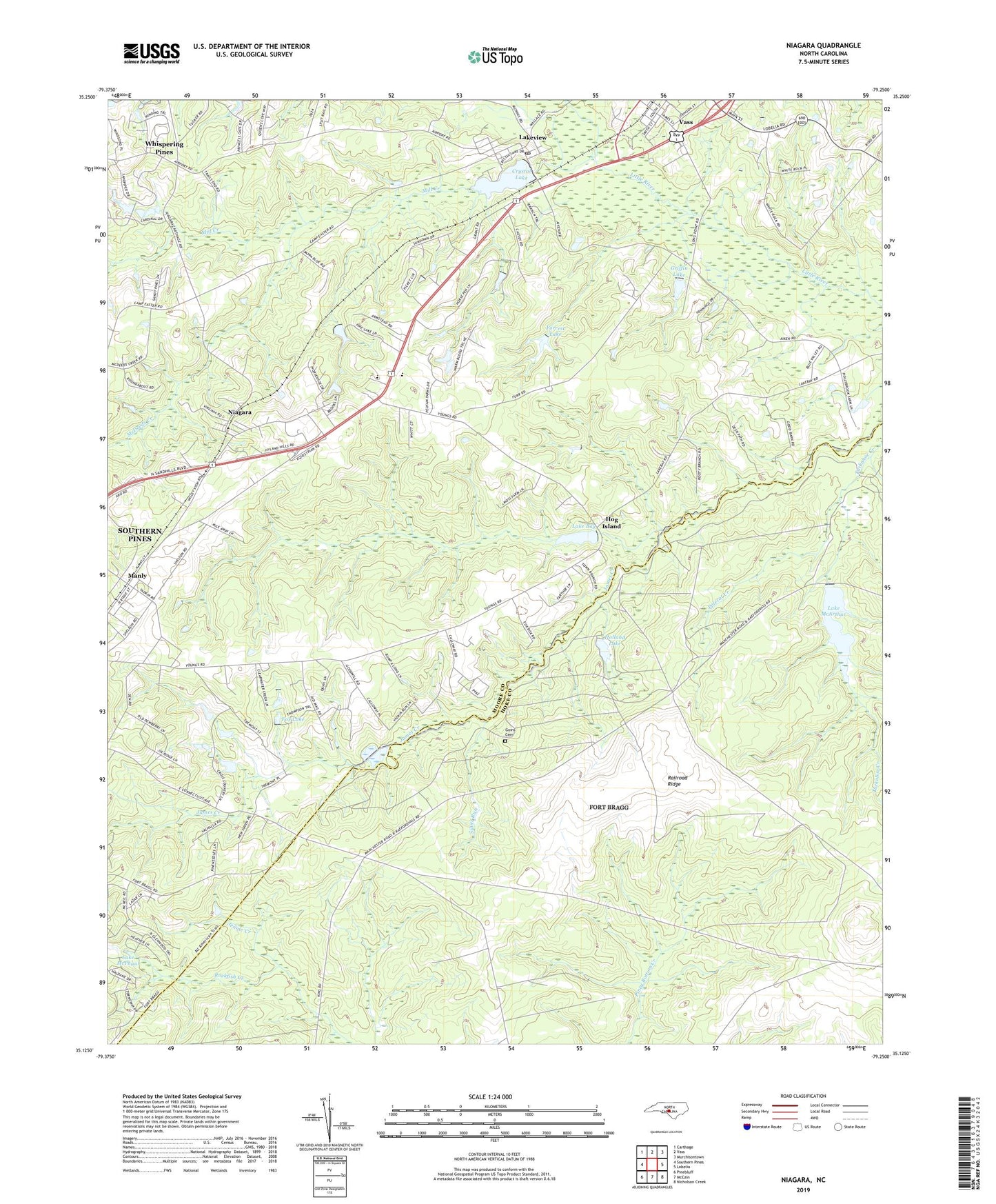
2022 topographic map quadrangle Niagara in the state of North Carolina. Scale: 1:24000. Based on the newly updated USGS 7.5' US Topo map series, this map is in the following counties: Moore, Hoke. The map contains contour data, water features, and other items you are used to seeing on USGS maps, but also has updated roads and other features. This is the next generation of topographic maps. Printed on high-quality waterproof paper with UV fade-resistant inks.
Quads adjacent to this one:
West: Southern Pines
Northwest: Carthage
North: Vass
Northeast: Murchisontown
East: Lobelia
Southeast: Nicholson Creek
South: McCain
Southwest: Pinebluff
This map covers the same area as the classic USGS quad with code o35079b3.
Contains the following named places: Crystal Lake, Crystal Lake Dam, Forrest Lake, Forrest Lake Dam, Fox Lake, Fox Lake Dam, Goins Cemetery, Griffin Lake, Griffins Lake Dam, Highland Baptist Church, Highland Christian Academy, Highland Trails, Hog Island, Holland Lake, Jennie Creek, Lake Bay, Lake MacArthur, Lake McPhaul, Lake McPhaul Dam, Lakeview, Lakeview Post Office, Manly, McDeeds Creek, Mill Creek, NC Noname Forty-Three Dam, NC Noname Thirty-Five Dam, New Home Church, Niagara, Old Notre Dame Academy, Pleasant Hill Church, Polecat Creek, Railroad Ridge, Ranger Station Number 2, Rebecca Green Dam, Rosendale Church, Silver Run, Township 7-McNeill, ZIP Code: 28350