MyTopo
Old Ford North Carolina US Topo Map
Couldn't load pickup availability
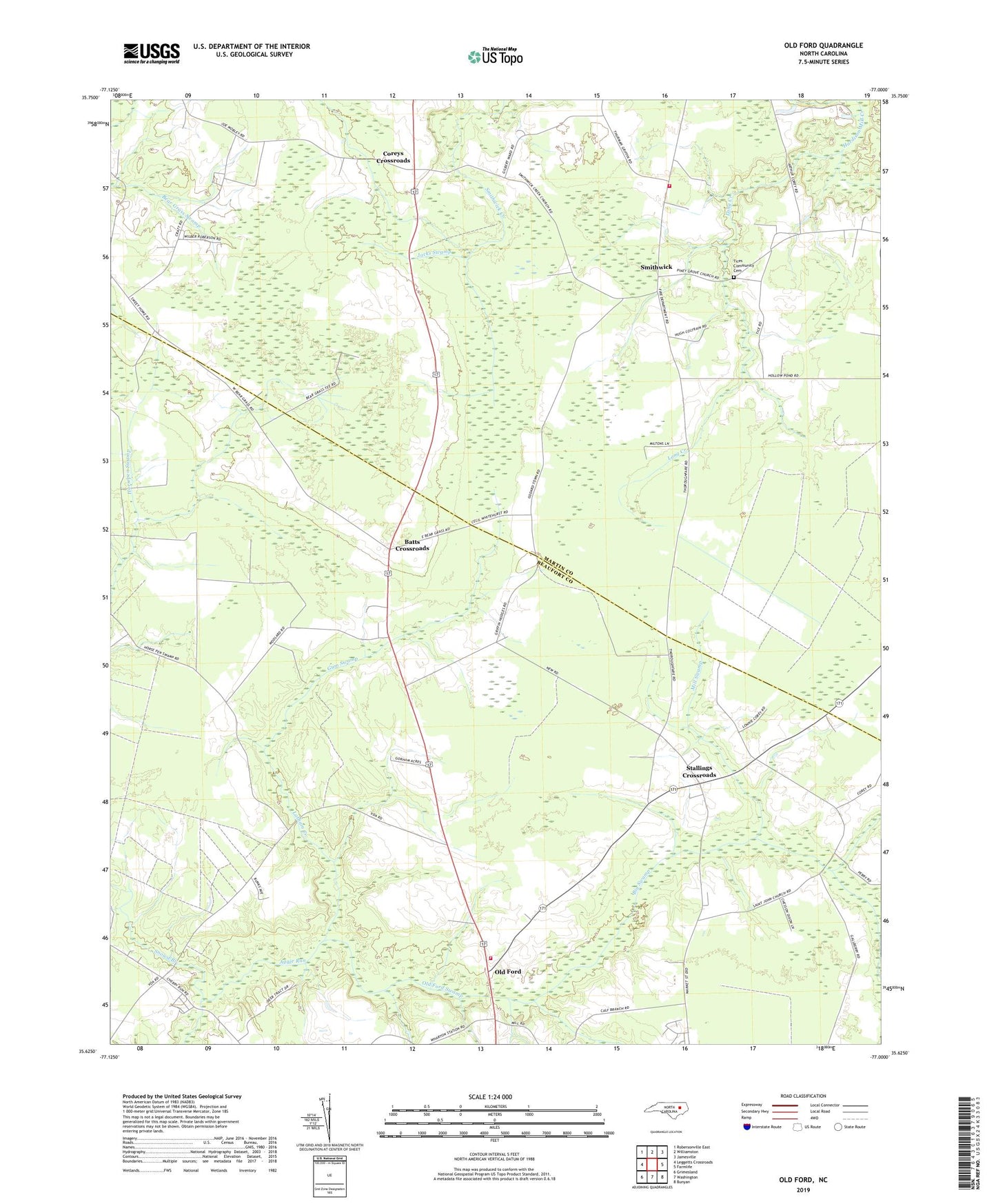
2019 topographic map quadrangle Old Ford in the state of North Carolina. Scale: 1:24000. Based on the newly updated USGS 7.5' US Topo map series, this map is in the following counties: Beaufort, Martin. The map contains contour data, water features, and other items you are used to seeing on USGS maps, but also has updated roads and other features. This is the next generation of topographic maps. Printed on high-quality waterproof paper with UV fade-resistant inks.
Quads adjacent to this one:
West: Leggetts Crossroads
Northwest: Robersonville East
North: Williamston
Northeast: Jamesville
East: Farmlife
Southeast: Bunyan
South: Washington
Southwest: Grimesland
Contains the following named places: Adamsville Church, Batts Crossroads, Big Swamp, Coreys Crossroads, Griffins Township Fire Department, Gum Swamp, Jacks Swamp, Latham Creek, Long Creek, Macedonia Church, Mill Swamp, Mount Carmel Holy Temple, Old Ford, Old Ford Swamp, Old Ford Volunteer Fire Department, Ore Temple Holy Church, Piney Grove Church, Saint Johns Church, Saint Matthews Church, Smithwick, Snowd Branch, Snowd Branch Church, Stallings Crossroads, Sweet Home Church, Tices Community Cemetery, Township of Washington