MyTopo
Grimesland North Carolina US Topo Map
Couldn't load pickup availability
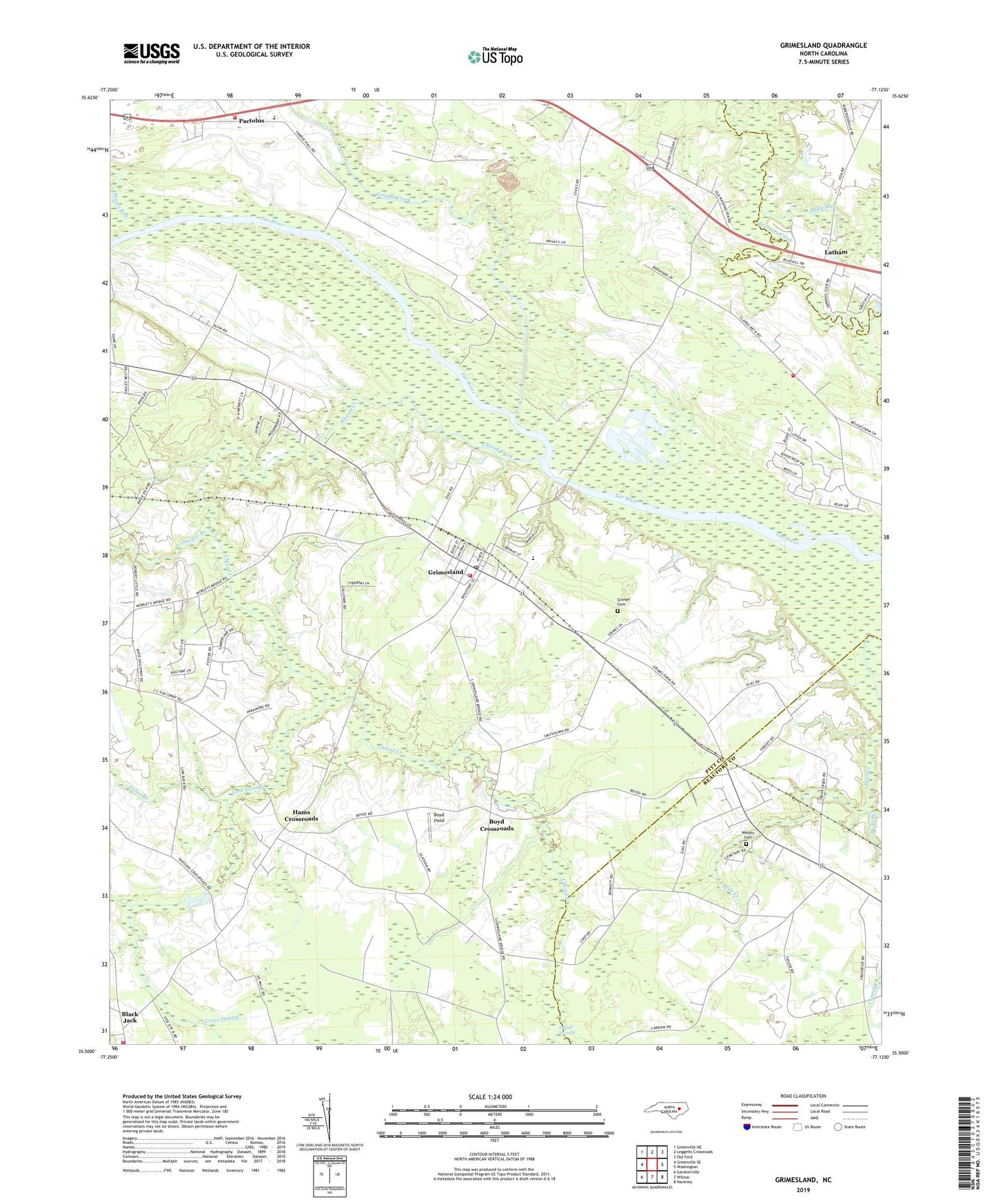
2022 topographic map quadrangle Grimesland in the state of North Carolina. Scale: 1:24000. Based on the newly updated USGS 7.5' US Topo map series, this map is in the following counties: Pitt, Beaufort. The map contains contour data, water features, and other items you are used to seeing on USGS maps, but also has updated roads and other features. This is the next generation of topographic maps. Printed on high-quality waterproof paper with UV fade-resistant inks.
Quads adjacent to this one:
West: Greenville SE
Northwest: Greenville NE
North: Leggetts Crossroads
Northeast: Old Ford
East: Washington
Southeast: Hackney
South: Wilmar
Southwest: Gardnerville
This map covers the same area as the classic USGS quad with code o35077e2.
Contains the following named places: Aggie Run, Avon Landing, Bible Way Church, Black Jack, Black Jack Fire Department, Blakleys Fishery, Boyd Crossroads, Boyd Ferry, Boyd Field, Broad Run, Bryan, Burneys Chapel, Cabin Branch, Chapel Branch, Chicod Creek, Clarks Landing, Clarks Neck Volunteer Fire Department Station 1, Cow Swamp, Cross Swamp, First Born Church, G R Whitefield School, Grimes Cemetery, Grimes Landing, Grimes Millpond, Grimesland, Grimesland Pentecostal Church, Grimesland Post Office, Grimesland Town and Rural Fire Department, Grindle Creek, Hams Crossroads, Hodges Chapel, Holy Ghost Deliverance Church, Island Swamp, Jones Chapel, Juniper Branch, Latham, One Way Church, Pactolus Elementary School, Pactolus Emergency Medical Services, Pactolus Volunteer Fire Department, Panther Creek, Piney Grove Church, Town of Grimesland, Township of Grimesland, Triumph Church, Wayside Church, Wesley Cemetery, White Oak Church, Yankee Hall, ZIP Code: 27837