MyTopo
Leggetts Crossroads North Carolina US Topo Map
Couldn't load pickup availability
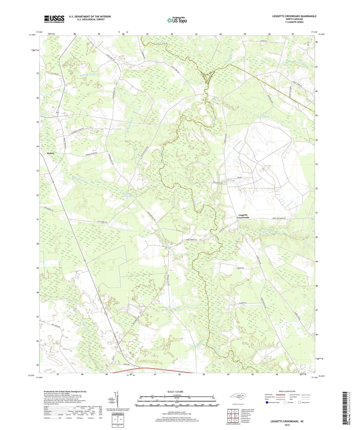
2022 topographic map quadrangle Leggetts Crossroads in the state of North Carolina. Scale: 1:24000. Based on the newly updated USGS 7.5' US Topo map series, this map is in the following counties: Pitt, Beaufort, Martin. The map contains contour data, water features, and other items you are used to seeing on USGS maps, but also has updated roads and other features. This is the next generation of topographic maps. Printed on high-quality waterproof paper with UV fade-resistant inks.
Quads adjacent to this one:
West: Greenville NE
Northwest: Robersonville West
North: Robersonville East
Northeast: Williamston
East: Old Ford
Southeast: Washington
South: Grimesland
Southwest: Greenville SE
This map covers the same area as the classic USGS quad with code o35077f2.
Contains the following named places: Bear Grass Swamp, Briery Swamp, Briery Swamp Church, Clemons Grove Chapel, Flat Swamp Church, Great Branch Meadow Branch, Haw Branch, Hayes Chapel, Horsepen Swamp, Hunting Run, Leggetts Crossroads, Pactolus, Pea Branch, Pinelog Branch, Piney Grove Church, Pocoson Branch, Poley Branch, Rose of Sharon Church, Shepard Millpond Dam, Sheppard Millpond, Stokes Elementary School, Township of Pactolus, Tranters Creek Church, Turkey Swamp, Union Grove Church, Voice of America