MyTopo
Oregon Inlet North Carolina US Topo Map
Couldn't load pickup availability
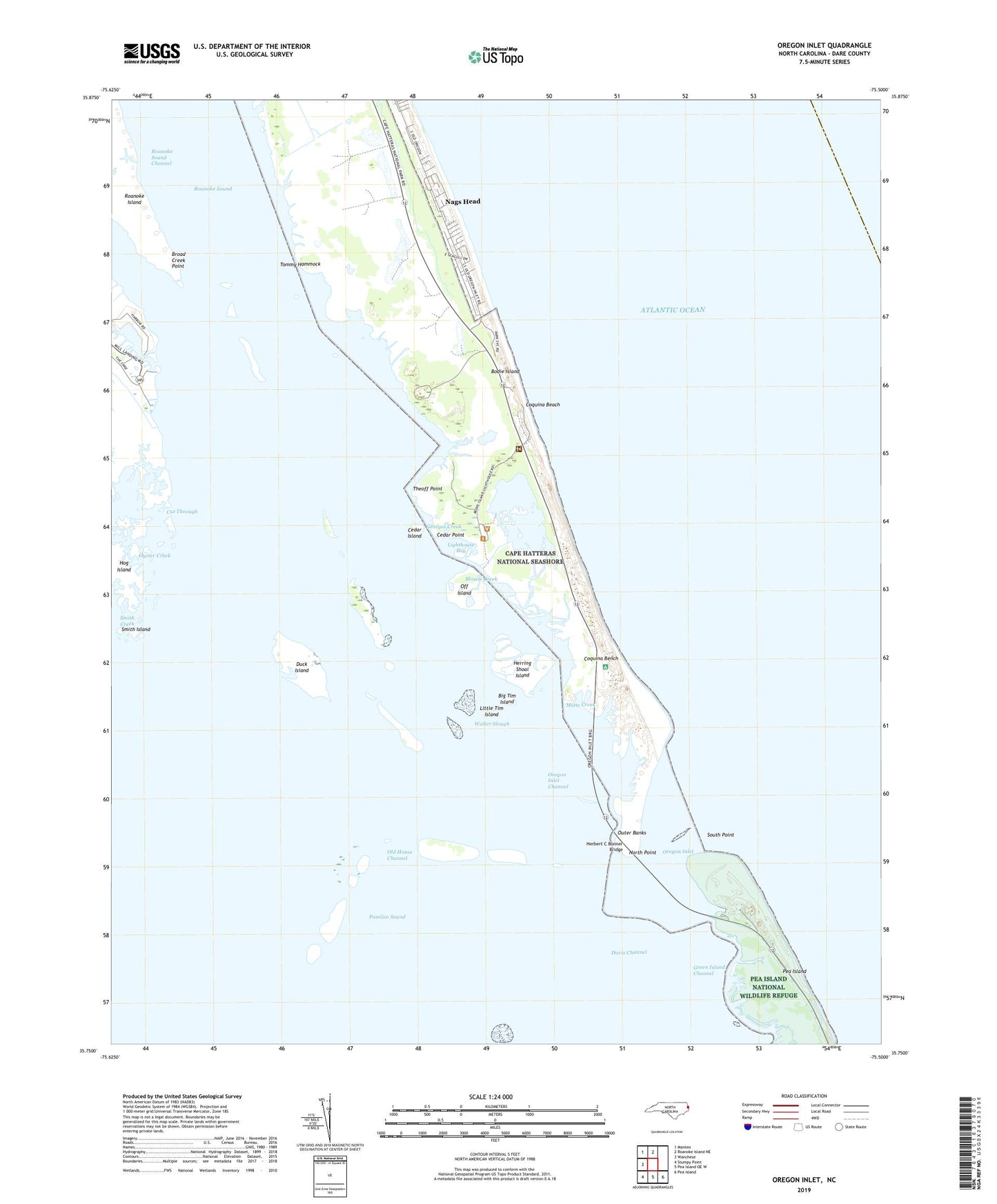
2019 topographic map quadrangle Oregon Inlet in the state of North Carolina. Scale: 1:24000. Based on the newly updated USGS 7.5' US Topo map series, this map is in the following counties: Dare. The map contains contour data, water features, and other items you are used to seeing on USGS maps, but also has updated roads and other features. This is the next generation of topographic maps. Printed on high-quality waterproof paper with UV fade-resistant inks.
Quads adjacent to this one:
West: Wanchese
Northwest: Manteo
North: Roanoke Island NE
Southeast: Pea Island
South: Pea Island OE W
Southwest: Stumpy Point
Contains the following named places: Big Tim Island, Billys Woods, Blossie Creek, Bodie Island Clubhouse, Bodie Island Lighthouse, Bodie Island Visitor Center, Broad Creek, Broad Creek Point, Cedar Island, Cedar Point, Chicamacomico Life Saving Station, Coast Guard Station Oregon Inlet, Coquina Beach, Coquina Bench, Cut Through, Davis Channel, Duck Island, Georges Creek, Green Island Channel, Herbert C Bonner Bridge, Herring Shoal Island, Hog Island, Lighthouse Bay, Little Tim Island, Mill Landing, Mill Landing Creek, Motts Creek, North Point, Off Island, Old House Channel, Oregon Inlet, Oregon Inlet Channel, Oregon Inlet Fishing Center, Oregon Inlet Lifeboat Station, Oregon Inlet Marina Convenience Store, Oyster Creek, Port Ferinando, Roanoke Sound, Roanoke Sound Channel, Smith Creek, Smith Island, South Point, Theoff Point, Thicket Lump Marina, Tommy Hammock, Walter Slough