MyTopo
Pea Island OE W North Carolina US Topo Map
Couldn't load pickup availability
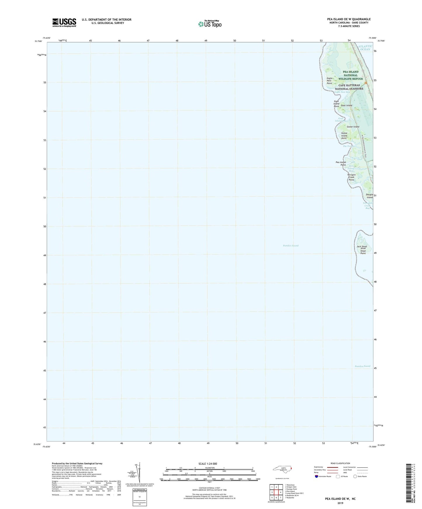
2022 topographic map quadrangle Pea Island OE W in the state of North Carolina. Scale: 1:24000. Based on the newly updated USGS 7.5' US Topo map series, this map is in the following counties: Dare. The map contains contour data, water features, and other items you are used to seeing on USGS maps, but also has updated roads and other features. This is the next generation of topographic maps. Printed on high-quality waterproof paper with UV fade-resistant inks.
Quads adjacent to this one:
West: Stumpy Point
Northwest: Wanchese
North: Oregon Inlet
East: Pea Island
Southeast: Rodanthe
South: Rodanthe OE W
Southwest: Long Shoal Point OE E
Contains the following named places: Douglas Island, Eagle Nest Bay, Eagle Nest Point, Goat Island, Goat Island Bay, Goat Island Point, Goose Island, Goose Island Point, Jack Shoal, Jesse Shoal Point, Maiden Paps, Pea Island Bay, Pea Island Creek, Pea Island Point, Terrapin Creek, Terrapin Creek Bay, Terrapin Creek Point, The Trench, ZIP Code: 27968