MyTopo
Stumpy Point North Carolina US Topo Map
Couldn't load pickup availability
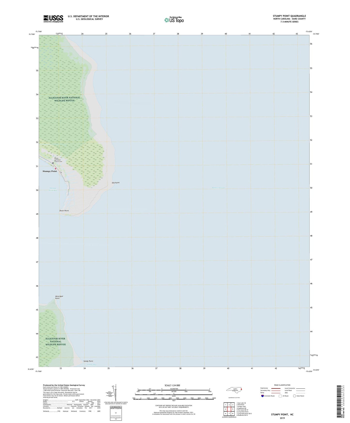
2022 topographic map quadrangle Stumpy Point in the state of North Carolina. Scale: 1:24000. Based on the newly updated USGS 7.5' US Topo map series, this map is in the following counties: Dare. The map contains contour data, water features, and other items you are used to seeing on USGS maps, but also has updated roads and other features. This is the next generation of topographic maps. Printed on high-quality waterproof paper with UV fade-resistant inks.
Quads adjacent to this one:
West: Engelhard NE
Northwest: East Lake SE
North: Wanchese
Northeast: Oregon Inlet
East: Pea Island OE W
Southeast: Rodanthe OE W
South: Long Shoal Point OE E
Southwest: Long Shoal Point
This map covers the same area as the classic USGS quad with code o35075f6.
Contains the following named places: Dare County, Drain Point, Old Point, Sandy Point, Shiloh Church, Shiloh Methodist Church Cemetery, Stumpy Point, Stumpy Point Volunteer Fire Department Station 19, Wild Boar Point, ZIP Code: 27978