MyTopo
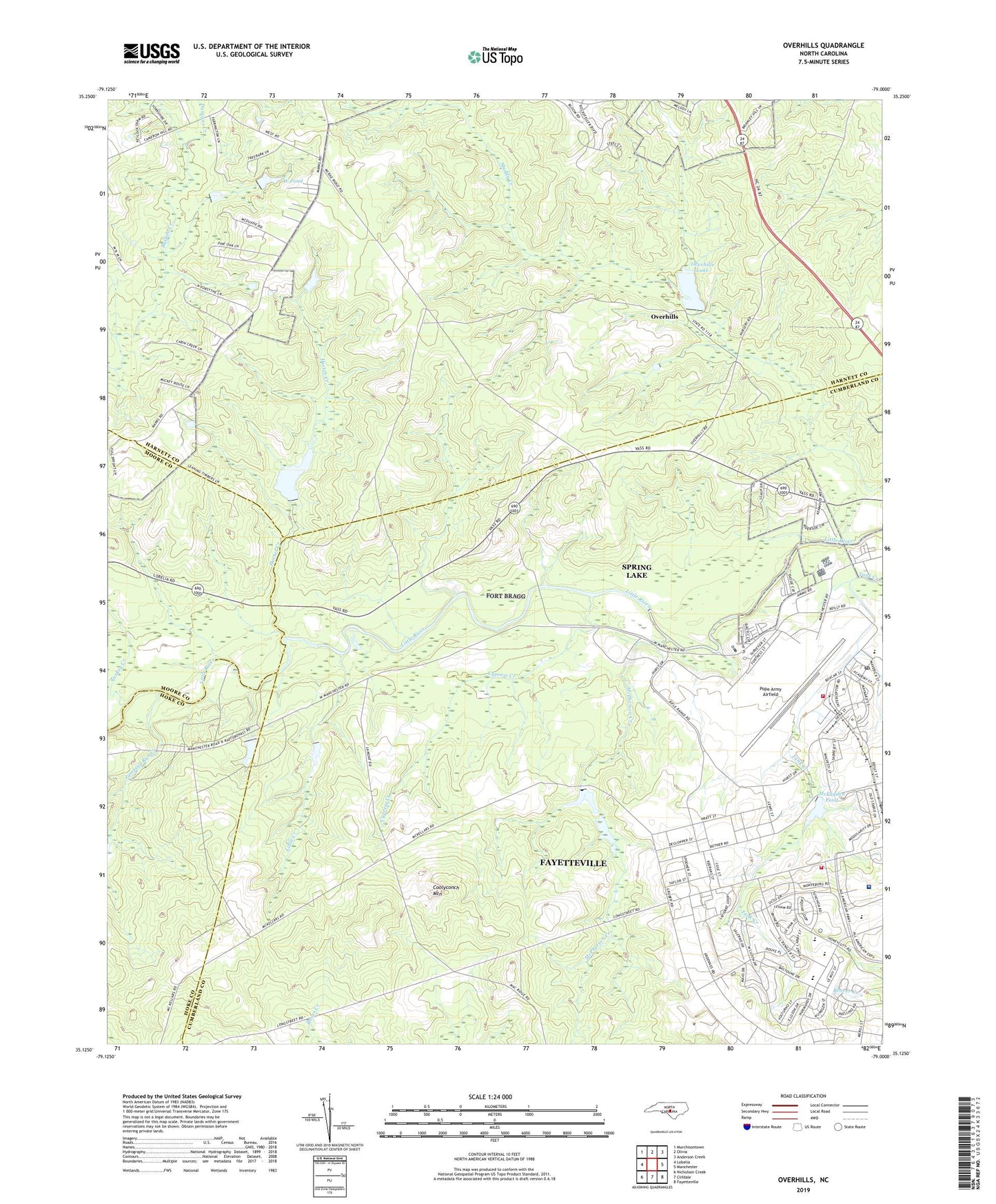
Overhills North Carolina US Topo Map
Couldn't load pickup availability
2019 topographic map quadrangle Overhills in the state of North Carolina. Scale: 1:24000. Based on the newly updated USGS 7.5' US Topo map series, this map is in the following counties: Cumberland, Harnett, Hoke, Moore. The map contains contour data, water features, and other items you are used to seeing on USGS maps, but also has updated roads and other features. This is the next generation of topographic maps. Printed on high-quality waterproof paper with UV fade-resistant inks.
Quads adjacent to this one:
West: Lobelia
Northwest: Murchisontown
North: Olivia
Northeast: Anderson Creek
East: Manchester
Southeast: Fayetteville
South: Clifdale
Southwest: Nicholson Creek
Contains the following named places: Cherbourg, Coolyconch Mountain, Cypress Creek, Duncans Creek, Fort Bragg, Fort Bragg Census Designated Place, Fort Bragg Fire and Emergency Services Station 3, Hammond Hills, Hector Creek, Jumping Run Creek, Kiest Lake, Little Creek, Lower McKellars Pond, McFayden Pond, McKellars Pond, McPherson Creek, Muddy Creek, Murray School, NC Noname Eighty-One Dam, NC Noname Forty-Five Dam, NC Noname Forty-Four Dam, NC Noname Forty-Six Dam, Nijmegen, Oconnell Dam, Overhills, Overhills Lake, Overhills Lake Dam, Pope Air Force Base, Pope Air Force Base Census Designated Place, Pope Air Force Base Fire Department Station 7, Pope Army Airfield, Pope Army Airfield Post Office, Saint Mere Eglise, Township of Manchester, Turkey Creek, Upper McKellars Pond, West Pond, West Pond Dam, Weyerhaeuser Company Dam, Womack Army Medical Center, ZIP Codes: 28308, 28310