MyTopo
Clifdale North Carolina US Topo Map
Couldn't load pickup availability
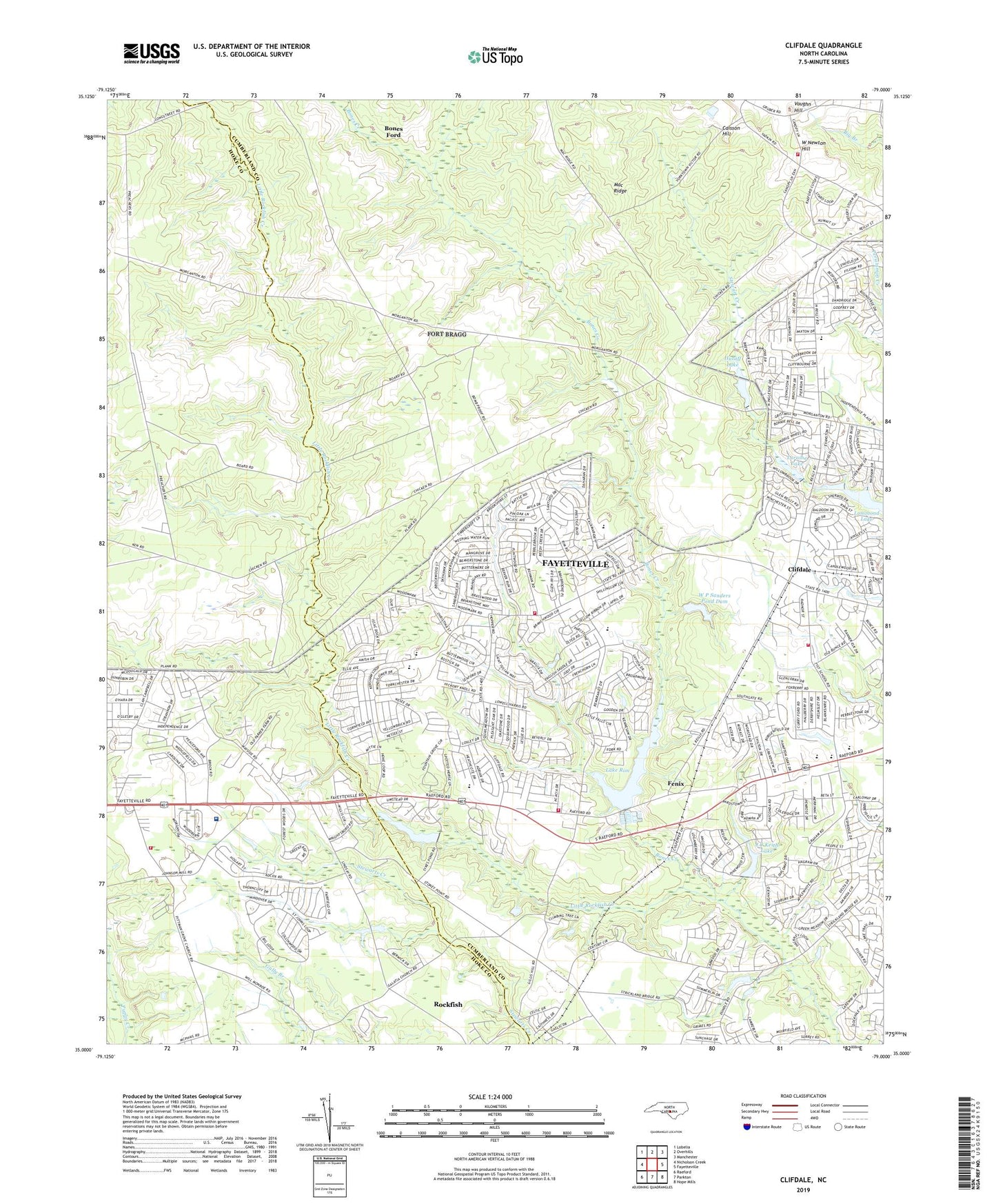
2022 topographic map quadrangle Clifdale in the state of North Carolina. Scale: 1:24000. Based on the newly updated USGS 7.5' US Topo map series, this map is in the following counties: Cumberland, Hoke. The map contains contour data, water features, and other items you are used to seeing on USGS maps, but also has updated roads and other features. This is the next generation of topographic maps. Printed on high-quality waterproof paper with UV fade-resistant inks.
Quads adjacent to this one:
West: Nicholson Creek
Northwest: Lobelia
North: Overhills
Northeast: Manchester
East: Fayetteville
Southeast: Hope Mills
South: Parkton
Southwest: Raeford
This map covers the same area as the classic USGS quad with code o35079a1.
Contains the following named places: Atlantic Coastal Plain, Benjamin J Martin Elementary School, Bluesprings Woods, Bones Creek, Bones Ford, Caisson Hill, Clifdale, Emerald Gardens, Fayetteville Fire Department Station 11, Fayetteville Fire Department Station 15, Fayetteville Fire Department Station 8, Fenix, Fort Bragg Fire and Emergency Services Station 5, Galatia Church, Glenbrook, Hickory Grove, Hutaff Lake, J C Keith Dam, J C Keith Lake, Lake Rim, Lake Rim Dam, Lake William, Lake Williams Dam, Loch Lommond, Lommond Lake, Longstreet Church, Loraine Lake, Loraine Lake Dam, Mac Ridge, NC Noname Eighty-Two Dam, Puppy Creek Fire Department, Saint James Inn Airport, Seventy-First Elementary School, Seventyfirst High School, Township of McLauchlin, Township of Seventy-First, Vaughn Hill, W P Sanders Pond Dam, West Newton Hill, ZIP Code: 28314