MyTopo
Pea Island North Carolina US Topo Map
Couldn't load pickup availability
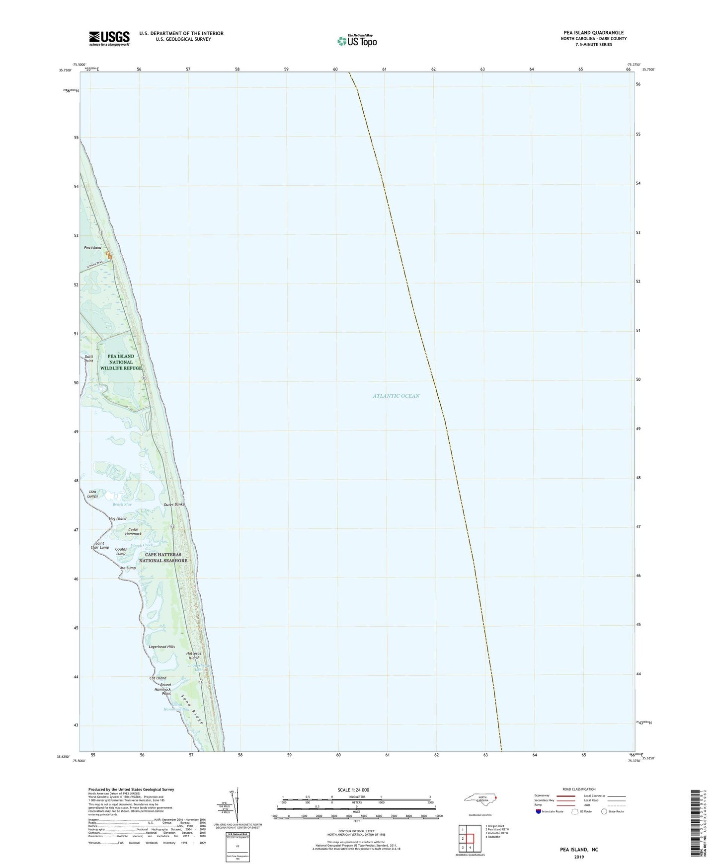
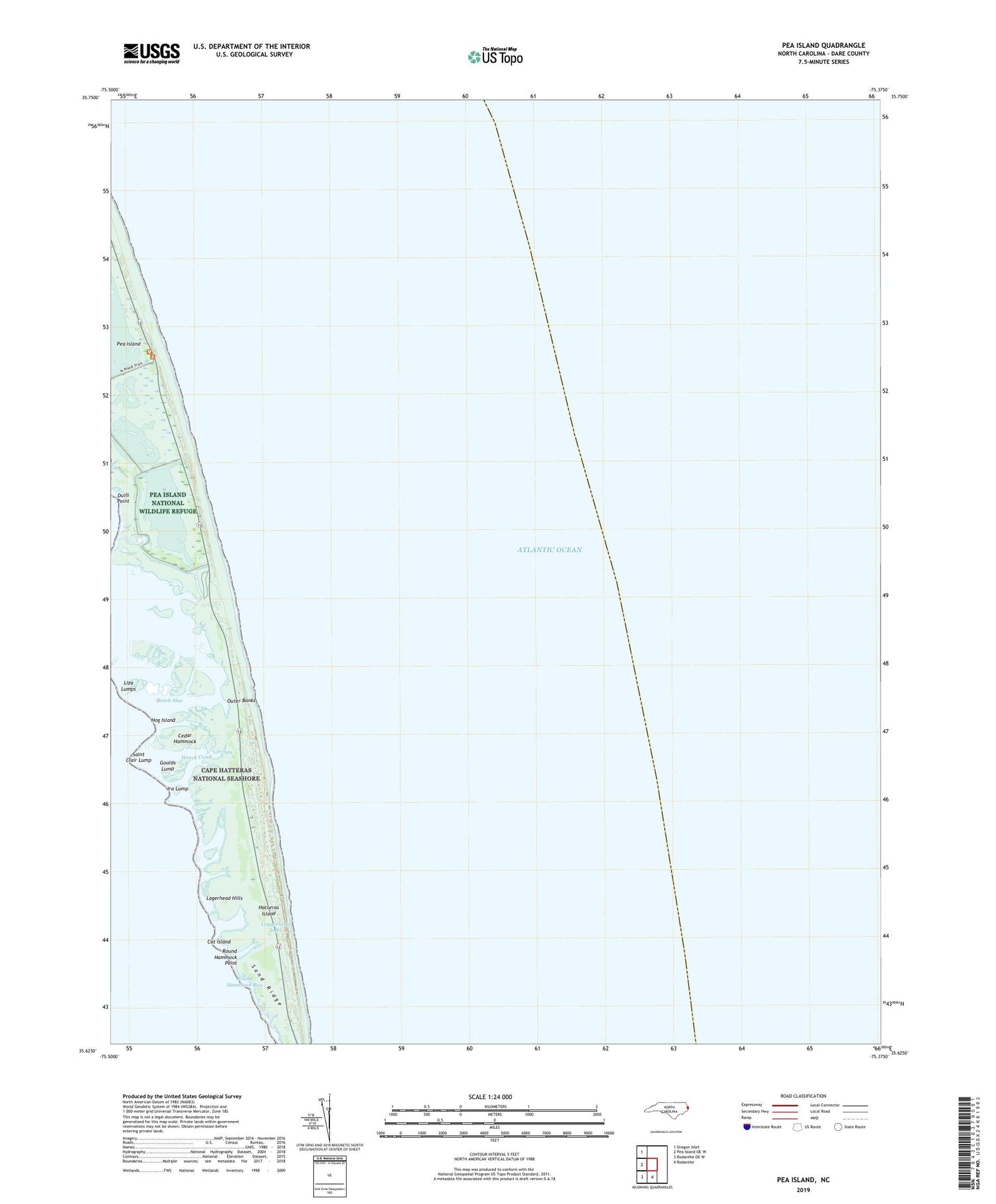
2019 topographic map quadrangle Pea Island in the state of North Carolina. Scale: 1:24000. Based on the newly updated USGS 7.5' US Topo map series, this map is in the following counties: Dare. The map contains contour data, water features, and other items you are used to seeing on USGS maps, but also has updated roads and other features. This is the next generation of topographic maps. Printed on high-quality waterproof paper with UV fade-resistant inks.
Quads adjacent to this one:
West: Pea Island OE W
Northwest: Oregon Inlet
South: Rodanthe
Southwest: Rodanthe OE W
Contains the following named places: Beach Slue, Cat Island, Cedar Hammock, Dulls Point, Fish Wildlife Service Headquarters, Goulds Lump, Hog Island, Ira Lump, Lagerhead Hills, Liza Lumps, Loggerhead Inlet, New Inlet, Pea Island, Pea Island National Wildlife Refuge, Round Hammock Bay, Round Hammock Point, Saint Clair Lump, Sand Ridge, Wreck Creek