MyTopo
Rodanthe North Carolina US Topo Map
Couldn't load pickup availability
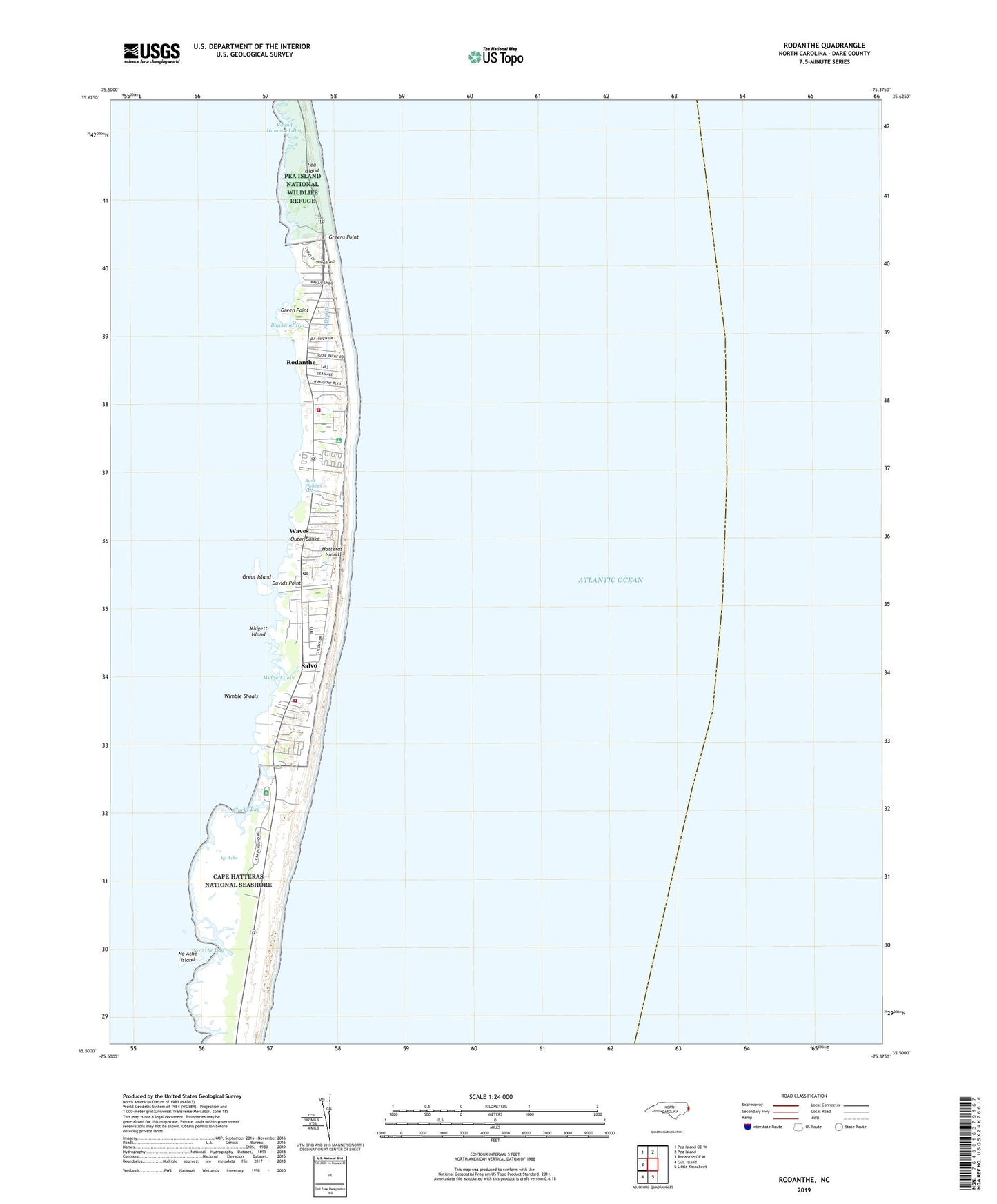
2022 topographic map quadrangle Rodanthe in the state of North Carolina. Scale: 1:24000. Based on the newly updated USGS 7.5' US Topo map series, this map is in the following counties: Dare. The map contains contour data, water features, and other items you are used to seeing on USGS maps, but also has updated roads and other features. This is the next generation of topographic maps. Printed on high-quality waterproof paper with UV fade-resistant inks.
Quads adjacent to this one:
West: Rodanthe OE W
Northwest: Pea Island OE W
North: Pea Island
South: Little Kinnakeet
Southwest: Gull Island
This map covers the same area as the classic USGS quad with code o35075e4.
Contains the following named places: Aunt Phoebes Marsh, Blackmar Gut, Chicamacomico Banks Volunteer Fire Department Station 50, Chicamacomico Channel, Chickinacommock, Clarks Bay, Dare County Emergency Medical Services Station 6, Davids Point, Great Island, Green Point, Greens Point, Midgett Cove, Midgett Island, National Park Service Headquarters, No Ache, No Ache Bay, No Ache Island, North Drain, Outer Banks, Pauls Ditch, Rodanthe, Rodanthe Census Designated Place, Rodanthe Post Office, Round Hammock Bay, Salvo, Salvo Census Designated Place, Salvo Fire Department Station 48, South Rodanthe, Steeple, Township of Kinnakeet, Uncle Jimmys Landing, Waves, Waves Census Designated Place, Waves Landing, Wimble Shoals, ZIP Codes: 27972, 27982