MyTopo
Pittsboro North Carolina US Topo Map
Couldn't load pickup availability
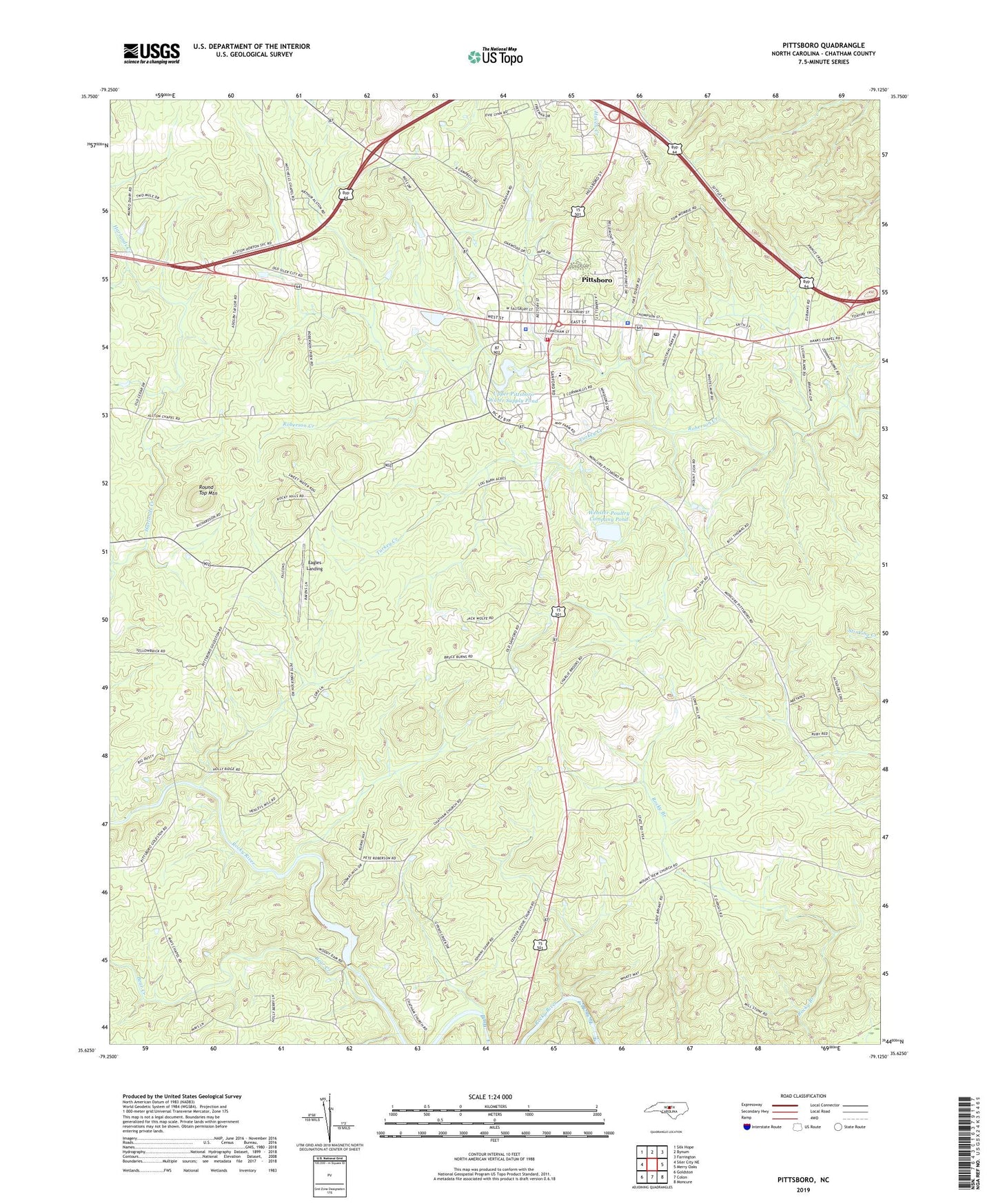
2019 topographic map quadrangle Pittsboro in the state of North Carolina. Scale: 1:24000. Based on the newly updated USGS 7.5' US Topo map series, this map is in the following counties: Chatham. The map contains contour data, water features, and other items you are used to seeing on USGS maps, but also has updated roads and other features. This is the next generation of topographic maps. Printed on high-quality waterproof paper with UV fade-resistant inks.
Quads adjacent to this one:
West: Siler City NE
Northwest: Silk Hope
North: Bynum
Northeast: Farrington
East: Merry Oaks
Southeast: Moncure
South: Colon
Southwest: Goldston
Contains the following named places: Alston Chapel, Bear Creek, Belmont Church, Center Grove Church, Chatham Church, Chatham County Sheriff's Office, Eagles Landing, East Chatham Rescue Squad, Horton Middle School, Mays Chapel, Mitchell Chapel, Mount Zion Church, Northwood High School, Old Rock Spring Church, Pittsboro, Pittsboro Elementary School, Pittsboro Fire Department, Pittsboro High School, Pittsboro Police Department, Pittsboro Post Office, Reeves Lake, Reeves Lake Dam, Round Top Mountain, Saint Matthews Church, Town of Pittsboro, Township of Center, Turkey Creek, Upper Pittsboro Water Supply Pond, Webster Poultry Company Pond, Webster Poultry Company Pond Dam