MyTopo
Southeast Lumberton North Carolina US Topo Map
Couldn't load pickup availability
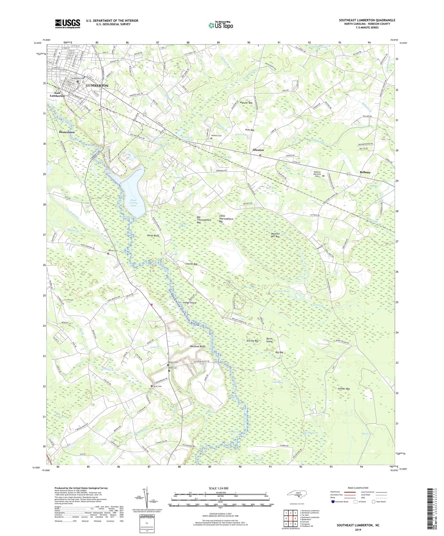
2022 topographic map quadrangle Southeast Lumberton in the state of North Carolina. Scale: 1:24000. Based on the newly updated USGS 7.5' US Topo map series, this map is in the following counties: Robeson. The map contains contour data, water features, and other items you are used to seeing on USGS maps, but also has updated roads and other features. This is the next generation of topographic maps. Printed on high-quality waterproof paper with UV fade-resistant inks.
Quads adjacent to this one:
West: Southwest Lumberton
Northwest: Northwest Lumberton
North: Northeast Lumberton
Northeast: Tar Heel
East: Bladenboro
Southeast: Chadbourn NE
South: Evergreen
Southwest: Fairmont
This map covers the same area as the classic USGS quad with code o34078e8.
Contains the following named places: Allenton, Allenton Volunteer Fire Department, Antioch Church, Ash Pond, Bear Bay, Bee Branch, Bellamy, Beulah Church, Big Bay, Big Branch Canal, Big Thoroughfare Bay, Blounts Bay, Blounts Branch, Bog Bay, Britt Cemetery, Britts Township Volunteer Fire Department, Broadridge Church, Burnt Island, Cedar Grove Church, Charles Bay, Cooling Lake Dam, Country Side Mobile Home Park, Cox Branch, Cypress Bay, East Lumberton, East Robeson School, Gabriel Bay, Gum Swamp, Hestertown, Hillburn Branch, Hollywood Cemetery, Horse Bluff, Horse Bluff Landing, Hyde Park Church, Indigo Island, Jacob Branch, Jacob Swamp, Janie C Hargrave Elementary School, Jess Ivy Bay, Juniper Bay, Lawson Cemetery, Lee Pond, Lennon Pond, Little Juniper Bay, Little Thoroughfare Bay, Long Branch, Long Branch Church, Long Branch School, Lumberton Police Department East Substation, Lumberton Rescue and EMS East Side, Lumberton Wastewater Treatment Plant, Matthew Bluff, Midway Church, Mill Swamp, Panther Bay, Panther Branch, Peters Branch, Peters Lake Landing, Peters Swamp, Phillips Mobile Home Park, Pigeon Bay, Pine Bay, Pinks Bay, Plant Cooling Lake, Pope Crossing, Popes Landing, Popular Bay, Reedy Branch, River Swamp, Robeson Memorial Park, Rowland Norment Elementary School, Singletary Cross Roads Church, Smyrna Church, Stone Grove Church, Tenmile Branch, Thorofare Swamp, Township of Britts, Township of Wisharts, Warwick Mill Bay, Warwick Mill Pond, West Mobile Home Park, Wilcox Cemetery, Wilson Branch, Wishart Cemetery, ZIP Code: 28358