MyTopo
Tomahawk North Carolina US Topo Map
Couldn't load pickup availability
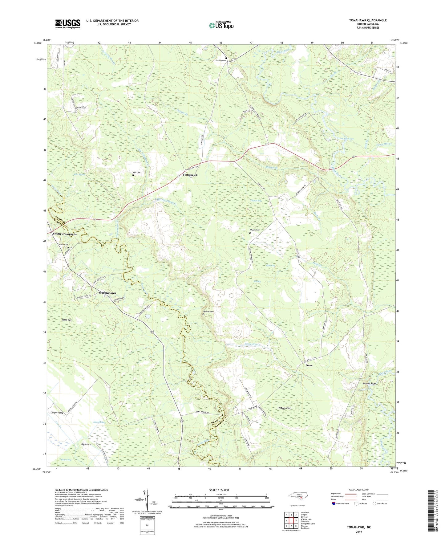
2019 topographic map quadrangle Tomahawk in the state of North Carolina. Scale: 1:24000. Based on the newly updated USGS 7.5' US Topo map series, this map is in the following counties: Sampson, Bladen. The map contains contour data, water features, and other items you are used to seeing on USGS maps, but also has updated roads and other features. This is the next generation of topographic maps. Printed on high-quality waterproof paper with UV fade-resistant inks.
Quads adjacent to this one:
West: White Lake
Northwest: Garland
North: Ingold
Northeast: Delway
East: Harrells
Southeast: Atkinson
South: Rowan
Southwest: Singletary Lake
Contains the following named places: Baylam Cemetery, Big Branch, Big Island, Big Tomahawk Creek, Bloody Bluff, Canty Mill Creek, Clear Run Middle School, Cobb Branch, Delta Landing, Devane Branch, Dismal Bay, Eb Bay, Enoch Mill Creek, Evening Light Chapel, Fennels Cove, Fowler Landing, Gingerberry, Harmony Church, Herring Cemetery, Jackie Landing, Juniper Branch, Keith Bay, Kelso Bay, Kerr, Kerr Cemetery, Kerr Marsh, Little Tomahawk Creek, Memorial Monument, Murphy Bay, Murphy Chapel, Murphytown, Newkirk Lookout Tower, Newton Cemetery, Pilgrim Rest Church, Pridgen Flats, Riverside Church, Rocky Branch, Sloans Bay, Smith Crossroads, Sutton Cemetery, Tomahawk, Tomahawk Church, Tomahawk Creek, Trinity Church, Trueway Church, ZIP Code: 28444