MyTopo
White Lake North Carolina US Topo Map
Couldn't load pickup availability
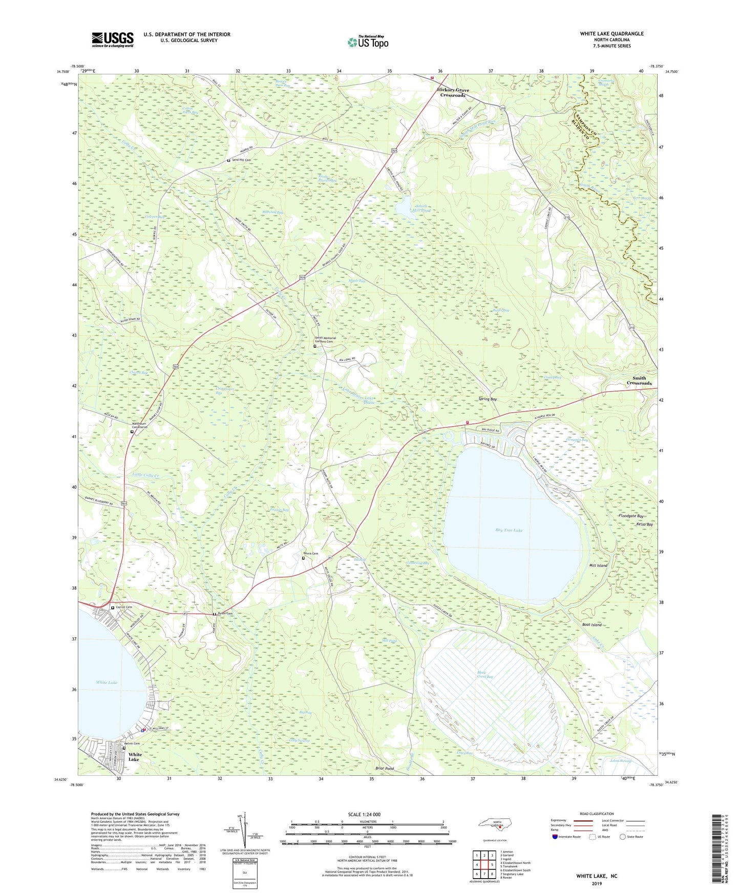
2022 topographic map quadrangle White Lake in the state of North Carolina. Scale: 1:24000. Based on the newly updated USGS 7.5' US Topo map series, this map is in the following counties: Bladen, Sampson. The map contains contour data, water features, and other items you are used to seeing on USGS maps, but also has updated roads and other features. This is the next generation of topographic maps. Printed on high-quality waterproof paper with UV fade-resistant inks.
Quads adjacent to this one:
West: Elizabethtown North
Northwest: Ammon
North: Garland
Northeast: Ingold
East: Tomahawk
Southeast: Rowan
South: Singletary Lake
Southwest: Elizabethtown South
This map covers the same area as the classic USGS quad with code o34078f4.
Contains the following named places: Bay Tree Lake, Bay Tree Lake State Park, Bay Tree Lakes Volunteer Fire Department, Beard Chapel, Beaver Dam Bay, Big Bay, Black Creek Bay, Boat Island, Boone Field Landing, Butler Bay, Carroll Cemetery, Causeway Bay, Chinquapin Bay, Church Bay, Church Landing, Colly Chapel, Cooley Bay, Cotton Patch Bay, Cowpen Bay, Cromartie Marsh, Dyson Cemetery, Entry Bay, Floodgate Bay, Hickory Grove Crossroads, Hickory Grove Volunteer Fire Department, Horsepen Bay, Jumping Run Creek, Lake Drain, Little Colly Creek, Maple Bay, Marshall Bay, Marshburn Cemeteries, Melvin Cemetery, Mill Island, Mill Pond, Norris Cemetery, Pleasant Hill Church, Pocosin Bay, Reedy Branch Bay, Saint Peters Church, Sand Hill Cemetery, Smith Memorial Gardens Cemetery, Smith Mill Pond, Smith Mill Pond Run, South River Church, Spring Bay, Till Bay, Town of White Lake, Township of Colly, White Lake, White Lake Airport, White Lake Church, White Lake Fire Department, White Lake Police Department, White Lake Post Office